BLOCLEats

The Lindfield Club

King Edward Hall
24 High Street
Lindfield
RH162HH

Food rating: ★★★★★ 5/5 stars
Updated: 28. January 2022

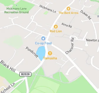
map for The Lindfield Club

Near The Lindfield …

  1. Bars & Nightclubs
  2. 0.1 miles★★★★★The Stand Up Inn, RH162HN
  3. 0.1 milesLe Flamant, RH162HL
  4. 0.1 miles★★★★★Red Lion, RH162HL
  5. 0.2 miles★★★★★The Bent Arms, RH162HP
  6. 0.2 miles★★★★★Lindfield Cricket Club, RH162EB
  7. 0.2 miles★★★★★Lindfield Football Club, RH162EB
  8. 0.3 miles★★★★★The Witch Inn, RH162AB
  9. 0.9 miles★★★★★Haywards Heath Football Club, RH163PT
  10. Care Facilities
  11. ★★★★★The Lindfield Nursery School, RH162HH
  12. Restaurants & Cafés
  13. ★★★★★Club Cuisine, RH162HH
  14. ★★★★★Truffles Bakery, RH162HL
  15. ★★★★Tamasha Spice, RH162HH
  16. Retail Stores
  17. Selbys Pharmacy, RH162HJ
  18. 0.1 milesAbbotts Pharmacy, RH162HN
  19. Supermarkets
  20. 0.1 miles★★★★★The Co-operative Food, RH162HJ
  21. Chemists
  22. Selbys Pharmacy, RH162HJ
  23. Schools
  24. 1.2 milesGreat Walstead School, RH162QL (319 pupils)
  25. Schools Primary
  26. 0.2 milesLindfield Primary Academy, RH162DX (660 pupils)
  27. 0.3 milesBlackthorns Community Primary Academy, RH162UA (210 pupils)
  28. 1.1 milesWarden Park Primary Academy, RH163JR (456 pupils)
  29. Schools Secondary
  30. 0.6 milesOathall Community College, RH162AQ (1246 pupils)

See all Bars & Nightclubs in Haywards Heath.