BLOCLEats

The Mountford

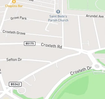
Mountford Hotel 52 - 54 Croxteth Road
Liverpool
L83SQ

Food rating: ★★★★★ 5/5 stars
Updated: 27. July 2022

map for The Mountford

Near The Mountford

  1. Bars & Nightclubs
  2. 0.3 miles★★★★★Chaplins Bar, L80QQ
  3. 0.4 miles★★★★★Sefton Park Cricket Club, L171AP
  4. 0.5 miles★★★The Green Man, L178UW
  5. 0.5 miles★★★★★The Albert, L178UU
  6. 0.5 miles★★The Old School House, L178UU
  7. 0.6 miles★★★★★Lost on Lark Lane, L178US
  8. 0.6 milesPetit Cafe Lark Lane, L178US
  9. 0.6 miles★★★★★Bar 25, L178UW
  10. Care Facilities
  11. 0.2 miles★★★★★Hestia House Care Home, L173AS
  12. 0.2 miles★★★★★Stepping Stones Nursery, L173DA
  13. Hotels & BnBs
  14. 0.2 miles★★★★★Hallmark Hotel, L173AA
  15. 0.2 miles★★★★★The Whitechapel Centre Hostel, L173AA
  16. Retail Stores
  17. 0.3 miles★★★★★The Wine Lodge, L80QQ
  18. 0.3 miles★★★★Your Local Pantry CCTC, L173BE
  19. School Food Ratings
  20. 0.3 miles★★★★★Bellerive FCJ Catholic College, L173AA
  21. Takeaway Shops
  22. 0.3 milesLevant, L80QE
  23. Schools
  24. 0.6 milesThe Belvedere Preparatory School, L83TF (161 pupils)
  25. Schools Primary
  26. 0.6 milesSt Clare's Catholic Primary School, L150DW (199 pupils)
  27. 0.6 milesKingsley Community School, L82TG (503 pupils)
  28. Schools Secondary
  29. 0.2 milesBellerive FCJ Catholic College, L173AA (911 pupils)
  30. 0.3 milesSt Hilda's Church of England High School, L173AL (1122 pupils)

See all Bars & Nightclubs in Liverpool.