BLOCLEats

The New Crown

Mowbray Road
South Shields
Tyne & Wear
NE333NG

Food rating: ★★★★★ 5/5 stars
Updated: 30. October 2023

Food ratings

Hygiene: 5
Structural: 5

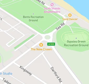
map for The New Crown

Near The New …

  1. Bars & Nightclubs
  2. 0.3 miles★★★The Sand Dancer, NE332LD
  3. 0.5 miles★★★★★The Bamburgh, NE346SS
  4. 0.5 miles★★★★★Dunes Adventure Island, NE332LD
  5. 0.5 miles★★★★The Rattler, NE332LD
  6. 0.5 miles★★★★★The New Sundial, NE332LD
  7. 0.6 miles★★★★★South Shields Catholic Mens Club Ltd, NE333PW
  8. 0.6 milesTrams, NE335PY
  9. 0.6 miles★★★★★The Fountain, NE346JL
  10. Care Facilities
  11. 0.1 miles★★★★★Wallace Mews, NE333NW
  12. 0.2 miles★★★★★Wallace Lodge, NE333HY
  13. Food Trucks
  14. 0.3 miles★★★★What's cooking, NE332LD
  15. Catering Services
  16. 0.3 miles★★★★★Toney Minchella Kiosk, NE332LD
  17. Restaurants & Cafés
  18. 0.3 miles★★★★★Olivia's (Oasis Amusement),
  19. 0.3 miles★★★★★S Tyneside Indoor Bowls & Social Club, NE333HE
  20. 0.3 miles★★★★★Mac N Alli, NE333PE
  21. Takeaway Shops
  22. 0.3 miles★★★★★Up North Pizza Co, NE333PE
  23. Schools 16 Plus
  24. 0.6 milesTyne Coast College, NE346ET
  25. Schools Primary
  26. 0.2 milesWestoe Crown Primary School, NE333NS (657 pupils)
  27. 0.6 milesMarine Park Primary School, NE332RD
  28. 0.7 milesSt Bede's Catholic Primary School, South Shields, NE334PG (232 pupils)
  29. 0.7 milesSea View Primary School, NE347TD (421 pupils)

See all Bars & Nightclubs in South Shields.