BLOCLEats

The Salvation Army

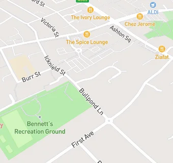
Worship & Community Centre
Bullpond Lane
Dunstable
Beds
LU63AH

Food rating: ★★★★★ 5/5 stars
Updated: 15. May 2024

map for The Salvation Army

Near The Salvation …

  1. Restaurants & Cafés
  2. ★★★★★Splashside Cafe, LU63AH
  3. 0.1 miles★★★★★Jaccs Coffee Shop Ltd, LU63AH
  4. 0.2 miles★★★★Olive Garden Restaurant, LU61TA
  5. 0.2 miles★★★★★The Way Coffee House, LU61SX
  6. 0.2 miles★★★D&D PICIOCA, LU63RZ
  7. 0.2 miles★★Cafe Nostalgia, LU61SX
  8. 0.2 miles★★★★★Yum-Yum-Cafe, LU61SL
  9. 0.2 miles★★★★The Spice Lounge, LU61SL
  10. Care Facilities
  11. 0.2 miles★★★★★Linden House Nursery, LU61SE
  12. Bars & Nightclubs
  13. 0.1 miles★★★★★The Victoria, LU61ST
  14. Retail Stores
  15. 0.1 miles★★★★★Kopernik Polish Supermarket, LU61SL
  16. School Food Ratings
  17. 0.1 miles★★★★★Icknield Lower School, LU63AG
  18. Takeaway Shops
  19. 0.2 miles★★★China Express, LU63SF
  20. 0.2 miles★★★★★Peri Peri Original, LU63SF
  21. 0.2 miles★★Marmaris Limited, LU61HX
  22. Dentists
  23. 0.1 milesFriars Walk Dental Practice, LU63JA
  24. Schools All Through
  25. 0.3 milesPriory Academy, LU54JA (791 pupils)
  26. Schools Primary
  27. 0.1 milesDunstable Icknield Lower School, LU63AG
  28. 0.3 milesWatling Lower School, LU63BJ (206 pupils)
  29. 0.4 milesAshton St Peter's VA C of E School, LU61EW (209 pupils)
  30. Schools Secondary
  31. 0.4 milesQueensbury Academy, LU63BU (1195 pupils)

See all Restaurants & Cafés in Dunstable.