BLOCLEats

The Salvation Army

New Street
Long Eaton
NG101HE

Food rating: ★★★★★ 5/5 stars
Updated: 30. September 2021

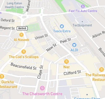
map for The Salvation Army

Near The Salvation …

  1. Catering Services
  2. ★★★★★Crossways Coffee Shop, NG101HD
  3. 0.1 miles ★★★★★The Chatsworth Art Centre, NG101EF
  4. 0.2 miles ★★★★★The United Bakes of America, NG101EQ
  5. 0.4 miles ★★★★Munchbox (The Dark Kitchen), NG104LA
  6. 0.5 miles ★★★★★Erewash Indoor Bowls, NG102EE
  7. 0.5 miles ★★★★★Insight Community Project CIC, NG104LL
  8. 0.7 miles Greenwood Community Centre, NG96LN
  9. 0.8 miles ★★★★★Welcome on Wednesday, NG104NL
  10. Care Facilities
  11. 0.1 miles ★★★★★Children 1st @ Breedon House, NG101GW
  12. Food Trucks
  13. 0.1 miles ★★★★★Tossed Dough, NG101GJ
  14. Restaurants & Cafés
  15. ★★★★★KFC, NG101HD
  16. 0.1 miles ★★★★★The Wonky Teapot, NG101GJ
  17. Supermarkets
  18. ★★★★★Farm Foods, NG101HD
  19. Takeaway Shops
  20. 0.1 miles ★★★★★Yo!, NG101HG
  21. Chemists
  22. Boots, NG101HZ
  23. 0.1 miles Jaysons Pharmacy, NG101JL
  24. Schools
  25. 0.7 miles Stanton Vale School, NG103NP (113 pupils)
  26. 0.8 miles OneSchool Global Uk Nottingham Campus, NG104HR (78 pupils)
  27. Schools Primary
  28. 0.4 miles Brooklands Primary School, NG101BW (401 pupils)
  29. 0.4 miles Grange Primary School, NG102DU (433 pupils)
  30. 0.5 miles St Laurence CofE Primary School, NG101DR (170 pupils)