BLOCLEats

The Salvation Army

Bowne Street
NG174BJ

Food rating: ★★★ 3/5 stars
Updated: 16. October 2024

Food ratings

Confidence in management: 10
Hygiene: 10
Structural: 5
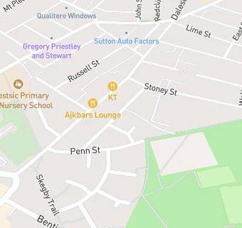
map for The Salvation Army

Near The Salvation …

  1. Catering Services
  2. 1.5 milesSergios Kitchen, NG196QW
  3. 1.9 miles★★★★★Open Door Coffee Shop, NG185JP
  4. 2.0 milesMazie Puceni 'Little Owl' Lavian Disprora School,
  5. 2.1 miles★★★★★L.J's, NG185NF
  6. 2.2 miles★★★★★Titchfield & Oakham Childrens Centre, NG185SL
  7. 2.3 miles★★★★★FoodCycle Mansfield, NG185SB
  8. 2.3 miles★★★★★Breakfast Club and After School Club, NG196TF
  9. 2.4 miles★★★★Mansfield Town Football Club, NG185DA
  10. Chemists
  11. 0.3 milesBoots, NG171BN
  12. 0.3 milesAsda Pharmacy, NG172AH
  13. 0.4 milesPeak Pharmacy, NG171AT
  14. 0.4 milesSuperdrug Pharmacy, NG171BP
  15. Dentists
  16. 0.4 milesChurch Street Partnership, NG171AE
  17. 0.4 milesThe Manor Dental Practice, NG171BG
  18. Doctors
  19. 0.4 milesKing's Medical Centre, NG171AT
  20. 0.4 milesKing's Medical Centre, NG171AT
  21. Schools Primary
  22. 0.1 milesPriestsic Primary and Nursery School, NG174BB (432 pupils)
  23. 0.3 milesForest Glade Primary School, NG174FL (239 pupils)
  24. 0.3 milesCroft Primary School, NG175FJ (383 pupils)
  25. 0.5 milesHillocks Primary Academy, NG174ND (310 pupils)
  26. Schools Secondary
  27. 0.3 milesSutton Community Academy, NG171EE (845 pupils)

See all Catering Services in Sutton in Ashfield.