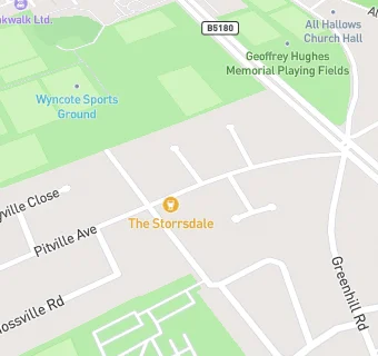
BLOCLEats

The Storrsdale

The Storrsdale Storrsdale Road
Liverpool
L187JY

Food rating: ★★★★★ 5/5 stars
Updated: 19. June 2018

map for The Storrsdale

Near The Storrsdale

  1. Bars & Nightclubs
  2. 0.4 miles★★★★★Haul Bottle Shop and Taproom, L188AG
  3. 0.4 miles★★★Rose of Mossley, L185EA
  4. 0.6 miles★★★★★The John Brodie Liverpool (88th Street, Value Mighty, Sin City Burger, Loco Loco, El Rodeo Mexicano, Burrito Bandits), L185HU
  5. 0.6 miles★★★★★The Allerton Oak, L185HU
  6. 0.6 miles★★★★★The Other Place, L182DD
  7. 0.8 miles★★★★★Heath Hall Catering Liverpool, L194UH
  8. 0.9 miles★★★★Dovedale Towers, L181DG
  9. 1.0 mile★★★★★Cressington Wine, L193QG
  10. Food Trucks
  11. ★★★★★Leisure United, L187JS
  12. Restaurants & Cafés
  13. ★★★★★Laros, L187JZ
  14. 0.3 miles★★★★★Costa Coffee, L186HF
  15. Retail Stores
  16. 0.4 miles★★★★★Rose Ann News, L185EA
  17. Supermarkets
  18. 0.3 miles★★★★★Tesco Stores Ltd, L186HF
  19. Takeaway Shops
  20. 0.3 milesYo! To Go!, L186HF
  21. Chemists
  22. 0.3 milesTesco Instore Pharmacy, L186HF
  23. Doctors
  24. Storrsdale Medical Centre, L187JY
  25. Schools Primary
  26. 0.4 milesBooker Avenue Infant School, L189SB (271 pupils)
  27. 0.4 milesBooker Avenue Junior School, L189SB (411 pupils)
  28. 0.6 milesSt Anthony of Padua Catholic Primary School, L188BD (217 pupils)
  29. 0.7 milesDovedale Community Primary School, L181JX (835 pupils)
  30. Schools Secondary
  31. 0.5 milesCalderstones School, L183HS (1597 pupils)

See all Bars & Nightclubs in Liverpool.