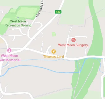
BLOCLEats

The Thomas Lord

High Street
West Meon
Petersfield
Hampshire
GU321LN

Food rating: ★★★★★ 5/5 stars
Updated: 28. June 2023

Food ratings

Hygiene: 5
Structural: 5

map for The Thomas Lord

Near The Thomas …

  1. Bars & Nightclubs
  2. 2.6 miles★★★★★Ye Olde George Inn, GU321NH
  3. 2.7 miles★★★★★The Izaak Walton, GU321QA
  4. 2.7 miles★★★★The Shoe, SO323NT
  5. 2.9 miles★★★★The Fox Inn, SO240LP
  6. 3.1 miles★★★★★Bucks Head, SO323NA
  7. 4.0 miles★★★★★The Hinton Arms, SO240NH
  8. 4.2 miles★★★★Bakers Arms, SO323PA
  9. 4.6 miles★★★★★The Milbury, SO240PB
  10. Food Trucks
  11. 0.4 miles★★★★★Sam's Mobile Catering, GU321JN
  12. Restaurants & Cafés
  13. 0.1 miles★★★★★Cuppacheeno, GU321LJ
  14. Retail Stores
  15. 0.1 miles★★★★Smith's Of West Meon, GU321LJ
  16. 0.1 miles★★★★★West Meon Village Shop, GU321LJ
  17. 1.4 miles★★★★★Rusdene Services Aka Budgens, GU321JX
  18. School Food Ratings
  19. 0.2 milesWest Meon Primary School, GU321LF
  20. Doctors
  21. 0.1 milesWest Meon Surgery, GU321LR
  22. 0.1 milesWest Meon Surgery, GU321LR
  23. Schools
  24. 1.8 milesBrockwood Park School, SO240LQ (84 pupils)
  25. Schools Primary
  26. 0.2 milesWest Meon Church of England Voluntary Controlled Primary School, GU321LF (52 pupils)
  27. 2.5 milesEast Meon Church of England Controlled Primary School, GU321NR (86 pupils)
  28. 3.3 milesMeonstoke Church of England Infant School, SO323NJ (50 pupils)
  29. 4.3 milesDroxford Junior School, SO323QR (168 pupils)

See all Bars & Nightclubs in West Meon.