BLOCLEats

The White Hart

2 Thorpe End
Melton Mowbray
LE131RB

Food rating: ★★★★★ 5/5 stars
Updated: 24. April 2024

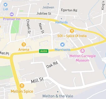
map for The White Hart

Near The White …

  1. Bars & Nightclubs
  2. 0.1 miles★★★★★Jacksons, LE131XD
  3. 0.1 miles★★★★★The Black Swan, LE131XJ
  4. 0.1 miles★★★★★The Boat Inn, LE131AF
  5. 0.1 miles★★★★★The Crown Inn, LE131AE
  6. 0.1 milesAnne Of Cleves, LE131AE
  7. 0.1 miles★★★★★The Royal British Legion, LE131RB
  8. 0.1 miles★★★★★Tubes Nightspot, LE131YE
  9. 0.1 miles★★★★★Cutting Room,KTown,FlusterCluck,Locked\&Loaded,88thSt,ValueMi, LE131YE
  10. Restaurants & Cafés
  11. ★★★★★Jasmine House, LE131XJ
  12. Retail Stores
  13. Post Office \& Bargain Booze, LE131XJ
  14. Takeaway Shops
  15. 0.1 miles★★★★★Dim Sum, LE131XH
  16. Chemists
  17. 0.1 milesDay-Night Pharmacy, LE131XH
  18. 0.1 milesAllied Pharmacy Melton Mowbray, LE131XH
  19. 0.1 milesDaynight Pharmacy, LE131NX
  20. 0.1 milesSuperdrug Pharmacy, LE131XH
  21. Doctors
  22. 0.1 milesLatham House Medical Practice, LE131NX
  23. Schools
  24. 0.8 milesBirch Wood (Melton Area Special School), LE131HA (228 pupils)
  25. Schools Primary
  26. 0.4 milesSaint Francis Catholic Primary School, LE130BP (200 pupils)
  27. 0.4 milesBrownlow Primary School, LE131QL (544 pupils)
  28. 0.6 milesThe Grove Primary School, LE130HN (174 pupils)
  29. 0.7 milesSherard Primary School, LE131HA (389 pupils)

See all Bars & Nightclubs in Melton Mowbray.