BLOCLEats

Trowel & Hammer

49 Pakefield Street
Lowestoft
Suffolk
NR330JS

Food rating: ★★★★★ 5/5 stars
Updated: 4. October 2024

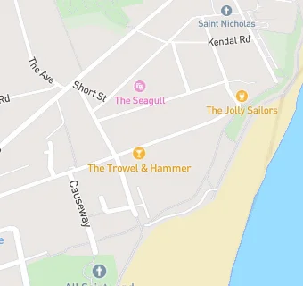
map for Trowel & Hammer

Near Trowel & …

  1. Bars & Nightclubs
  2. 0.1 miles★★★★★The Carlton Public House, NR330LF
  3. 0.2 miles★★★★★Tramway Hotel, NR337AA
  4. 0.3 miles★★★★★Oddfellows Arms, NR337AU
  5. 0.4 miles★★★★Kirkley & Pakefield Community Sports & Social Club, NR337LE
  6. 0.4 miles★★★★★The Ship Inn, NR337HW
  7. 0.5 miles★★★★★Lowestoft Masonic Hall - Bar, NR337LJ
  8. 0.6 milesCarlton Road Sports And Social Club, NR330LZ
  9. 0.6 miles★★★★★The Fighting Cocks, NR330NA
  10. Care Facilities
  11. 0.2 miles★★★★★Squirrel Lodge, NR330PD
  12. Restaurants & Cafés
  13. ★★★★The Jolly Sailors, NR330JS
  14. 0.1 miles★★★★★Topcats Community Cafe Project, NR330JH
  15. Retail Stores
  16. 0.1 miles★★★★★Seagull Theatre, NR330JH
  17. 0.1 miles★★★★Premier Convenience, NR330JT
  18. 0.2 miles★★★★★East Coast Fish, NR330JA
  19. 0.2 miles★★★★★Morton Convenience, NR330JQ
  20. Takeaway Shops
  21. ★★★★★Pakefield Plaice, NR330JS
  22. Schools Primary
  23. 0.5 milesPakefield Primary School, NR337AQ (342 pupils)
  24. 0.5 milesSt Mary's Roman Catholic Primary School, NR330DG (189 pupils)
  25. 0.7 milesWestwood Primary School, NR339RR (206 pupils)
  26. 0.7 milesPhoenix St Peter Academy, NR330NE (108 pupils)
  27. Schools Secondary
  28. 0.6 milesPakefield High School, NR337AQ (687 pupils)

See all Bars & Nightclubs in Lowestoft.