BLOCLEats

W H Smith

W H Smith Phase 2 Mri
Oxford Road
Manchester
M139WL

Food rating: ★★★★★ 5/5 stars
Updated: 13. June 2023

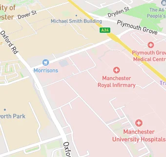
map for W H Smith

Near W H …

  1. Retail Stores
  2. 0.1 miles ★★★★★Greggs, M139NG
  3. 0.1 miles ★★★★★Marks & Spencer Simply Foods, M139WL
  4. 0.1 miles ★★★★★W H Smith Central Manchester Hospital - Main, M139WL
  5. 0.3 miles ★★★★Superdrug Stores Plc, M139PD
  6. 0.4 miles ★★★★The Place, M139PL
  7. 0.4 miles ★★★★United Halal Centre, M145TP
  8. 0.4 miles ★★KMCR Limited, M130AF
  9. 0.4 miles ★★★★★Araby, M145TP
  10. Care Facilities
  11. ★★★★★Royal Manchester Childrens Hospital (Special Feed Unit), M139WL
  12. Bars & Nightclubs
  13. 0.1 miles ★★★★★The Ford Madox Brown, M139NG
  14. Restaurants & Cafés
  15. ★★★★★Royal Voluntary Service (Pop Up), M139WL
  16. ★★★★★Starbucks, M139WL
  17. 0.1 miles ★★★★★Costa (Adults), M139WL
  18. 0.1 miles ★★★★★Eye Cafe, M139WL
  19. 0.1 miles ★★★★★Central Manchester University Hospitals NHS Foundation Trust, M139WL
  20. Supermarkets
  21. 0.1 miles ★★★★★Morrisons, M139NU
  22. Schools
  23. 0.2 miles Manchester Hospital School, M139WL (198 pupils)
  24. 0.4 miles University of Manchester, M139PL
  25. Schools Primary
  26. 0.3 miles St Chrysostom's CofE Primary School, M130DX (474 pupils)
  27. 0.4 miles Holy Name Roman Catholic Primary School Manchester, M156JS (224 pupils)
  28. Schools Secondary
  29. 0.4 miles Manchester Academy, M144PX (1086 pupils)