BLOCLEats

W H Smiths

Within Salford Royal Nhs Foundation Trust
Stott Lane
Salford
M68HD

Food rating: ★★★★★ 5/5 stars
Updated: 13. September 2018

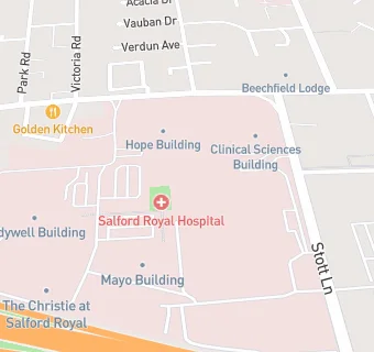
map for W H Smiths

Near W H …

  1. Retail Stores
  2. 0.2 miles ★★★★Premier Stores, M68HA
  3. 0.2 miles Gilda Brook Post Office, M68HH
  4. 0.4 miles ★★★★★The Range, M501ZD
  5. 0.5 miles ★★★Best One, M68LD
  6. 0.6 miles ★★★★Dave's Quality Butchers, M300EA
  7. 0.6 miles ★★★★Morrisons Petrol Station, M300FH
  8. 0.8 miles Flock And Gaggle, M501DL
  9. 0.8 miles Ace Conditioning, M171SR
  10. Care Facilities
  11. 0.1 miles ★★★★★Holyrood Salford Royal, M68FJ
  12. 0.2 miles ★★★★★Beechfield Lodge, M68AG
  13. Restaurants & Cafés
  14. 0.1 miles ★★★★Meadowbrook Patient Kitchen, M68HG
  15. 0.2 miles ★★★★★Warmspace, M68AG
  16. Supermarkets
  17. ★★★★★Marks & Spencer Simply Food, M68HD
  18. Takeaway Shops
  19. 0.1 miles ★★★★Shakebox, M68HA
  20. 0.2 miles ★★★★★Subway, M68HA
  21. Chemists
  22. 0.1 miles Well, M68HA
  23. Schools
  24. 0.3 miles Arbour Academy, M55AG (13 pupils)
  25. 0.5 miles Clarendon Cottage Preparatory School, M309BJ (108 pupils)
  26. Schools Primary
  27. 0.5 miles Clarendon Road Community Primary School, M309BJ (344 pupils)
  28. 0.6 miles Light Oaks Junior School, M68LU (351 pupils)
  29. Schools Secondary
  30. 0.4 miles All Hallows RC High School, M68AA (736 pupils)