BLOCLEats

Warminster Community Hospital

WARMINSTER COMMUNITY HOSPITAL THE AVENUE
WARMINSTER
BA128QS

Food rating: ★★★★★ 5/5 stars
Updated: 15. September 2023

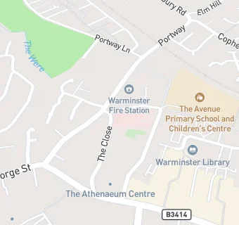
map for Warminster Community Hospital

Near Warminster Community …

  1. Care Facilities
  2. 0.1 miles★★★★★The Avenue Childrens Centre, BA129AA
  3. 0.3 miles★★★★★Barney Lodge Nursery School, BA120AN
  4. 0.4 miles★★★★★Wren House Care Home, BA128JF
  5. 0.6 miles★★★★★Ashwood Care Centre, BA129LR
  6. 0.7 miles★★★★★The Acorns After School Club, BA128NT
  7. 0.7 miles★★★★★Henford House, BA129PB
  8. 0.7 milesThe Willows Residential Home, BA129JN
  9. 0.8 miles★★★★★Warminster Bright Beginnings, BA120BY
  10. Logistics Providers
  11. Warminster And District Foodbank, BA129AL
  12. Bars & Nightclubs
  13. ★★★★★The Prestbury Sports Bar, BA129AL
  14. Retail Stores
  15. 0.1 miles★★★★★Greggs, BA129BT
  16. Supermarkets
  17. 0.1 miles★★★★★Iceland Frozen Foods Plc, BA129BT
  18. School Food Ratings
  19. 0.1 miles★★★★★Acorn Avenue Primary School, BA129AA
  20. Dentists
  21. 0.1 milesMydentist, BA129AF
  22. Doctors
  23. 0.1 milesAvenue Surgery, BA129AA
  24. 0.1 milesThe Avenue Surgery, BA129AA
  25. Schools
  26. 0.3 milesWarminster School, BA128PJ (529 pupils)
  27. Schools Primary
  28. 0.1 milesThe Avenue Primary School and Children's Centre, BA129AA (265 pupils)
  29. 0.3 milesThe Minster CofE Primary School, BA128JA (210 pupils)
  30. 0.4 milesNew Close Primary School, BA129JJ (136 pupils)
  31. 0.5 milesSambourne Church of England Voluntary Controlled Primary School, BA128LF (119 pupils)

See all Care Facilities in Warminster.