BLOCLEats

WH Smith

Ipswich Main Whsmith
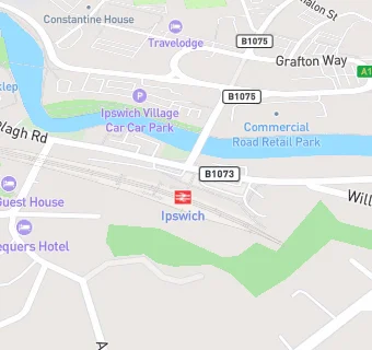
Railway Station
Burrell Road
Ipswich
IP28AL

Food rating: ★★★★★ 5/5 stars
Updated: 28. November 2016

map for WH Smith

Near WH Smith

  1. Retail Stores
  2. 0.1 miles ★★★★★Majestic Wine, IP11UZ
  3. 0.3 miles ★★★★★Stoke Community Pantry, IP28DA
  4. 0.3 miles ★★★★★Voyage Newsagent, IP20EH
  5. 0.3 miles ★★★★★MG Ipswich Ltd, IP20EH
  6. 0.4 miles ★★★★★Three Penny Convenience Store, IP11XH
  7. 0.4 miles ★★★Stoke Off Licence, IP28DF
  8. 0.4 miles ★★★★★Ipswich Blue Star, IP11RY
  9. 0.4 miles International Food Store, IP28DF
  10. Care Facilities
  11. 0.1 miles ★★★★★Consensus Support Ltd,
  12. Hotels & BnBs
  13. 0.2 miles ★★★★★The Station Hotel, IP28AB
  14. Food Trucks
  15. 0.2 miles ★★★★★Booty Burgers, IP28AB
  16. Restaurants & Cafés
  17. ★★★★★Costa Coffee, IP28AL
  18. ★★★★★Greggs, IP28AL
  19. 0.2 miles ★★★★★Travelodge Ipswich Central,
  20. Takeaway Shops
  21. ★★★★★Starbucks, IP28AL
  22. 0.2 miles ★★★★★PFK Kebab House, IP20EH
  23. Schools
  24. 0.6 miles Stone Lodge Academy, IP29HW (170 pupils)
  25. Schools Primary
  26. 0.4 miles Hillside Primary School, IP28NU (419 pupils)
  27. 0.6 miles St Matthew's Church of England Primary School, Ipswich, IP12AX (415 pupils)
  28. 0.6 miles Halifax Primary School, IP28PY (419 pupils)
  29. Schools Secondary
  30. 0.5 miles Stoke High School - Ormiston Academy, IP28PL (783 pupils)