BLOCLEats

Wheatsheaf

The Wheatsheaf Public House
286 High Street
Harlington
UB35DU

Food rating: ★★★★ 4/5 stars
Updated: 25. October 2021

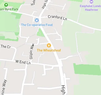
map for Wheatsheaf

Near Wheatsheaf

  1. Bars & Nightclubs
  2. 0.2 miles ★★★★★The Pheasant PH, UB35LX
  3. 0.3 miles ★★★White Hart, UB35DP
  4. 0.5 miles ★★★★Airport Bowl - Barcelos - Airport Lounge Bar, UB35AL
  5. 0.7 miles ★★★★★The Three Magpies, TW62AU
  6. 0.8 miles ★★★★The Great Western, UB31NF
  7. 1.0 mile ★★★★King William IV, UB70HT
  8. 1.1 miles ★★★The Plough, UB70HW
  9. 1.2 miles ★★★★★The Music Box (Pub), UB31QT
  10. Hotels & BnBs
  11. 0.3 miles ★★★★★Stay Belvedere Hotels LTD, UB35DX
  12. 0.3 miles ★★★★★London Heathrow Marriott Hotel, UB35AN
  13. Restaurants & Cafés
  14. 0.3 miles ★★★★★Starbucks, UB35BP
  15. 0.3 miles ★★★★★Madhu's Heathrow, UB35BP
  16. Takeaway Shops
  17. ★★★★★Traditions Catering, UB35DU
  18. Chemists
  19. 0.1 miles The Village Pharmacy, UB35DS
  20. Dentists
  21. 0.3 miles The Village Dental Practice, UB35DA
  22. Doctors
  23. 0.3 miles Glendale Medical Centre, UB35DA
  24. Schools
  25. 0.9 miles Lady Nafisa School, UB70JG (87 pupils)
  26. 1.0 mile The Cedars Primary School, TW59RU (65 pupils)
  27. Schools Primary
  28. 0.3 miles William Byrd Primary Academy, UB35EW (567 pupils)
  29. 0.9 miles Pinkwell Primary School, UB31PG (616 pupils)
  30. Schools Secondary
  31. 0.8 miles Harlington School, UB31PB (1317 pupils)