BLOCLEats

WHSmith

W H Smith
Bishops Stortford Railway Station
Station Road
Bishops Stortford
CM233BL

Food rating: ★★★★★ 5/5 stars
Updated: 22. March 2024

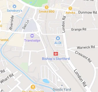
map for WHSmith

Near WHSmith

  1. Retail Stores
  2. 0.2 miles ★★★★Post Office Hockerill Street, CM232DW
  3. 0.2 miles ★★★★Polonia Deli Ltd, CM233BL
  4. 0.2 miles ★★★★★Oisoy, CM233DY
  5. 0.2 miles ★★★★★Station Off Licence, CM233BL
  6. 0.2 miles ★★★★★Stort Biltong Ltd, CM233DH
  7. 0.2 miles Oxfam, CM233AB
  8. 0.2 miles Trinity Pharmacy, CM233AL
  9. 0.3 miles Claire's Accessories, CM233XQ
  10. Bars & Nightclubs
  11. ★★★★★The Rose & Crown, CM233BL
  12. 0.1 miles ★★★★★Bacchus Bar, CM233BP
  13. 0.1 miles ★★★★★Three Tuns, CM235NF
  14. Restaurants & Cafés
  15. 0.1 miles ★★★★Nuffield Health, CM233BP
  16. 0.1 miles ★★★★Essentials At The Maltings, CM233DH
  17. Supermarkets
  18. 0.1 miles ★★★★★East Of England Co-operative Society, CM233FU
  19. 0.1 miles ★★★★★Aldi Stores Ltd, CM235NF
  20. Takeaway Shops
  21. 0.1 miles ★★★★★Kebabery, CM233BJ
  22. Schools
  23. 0.4 miles White Trees Independent School, CM235NA (58 pupils)
  24. Schools Primary
  25. 0.4 miles Windhill21, CM232NE (448 pupils)
  26. 0.4 miles Thorn Grove Primary School, CM235LD (222 pupils)
  27. Schools Secondary
  28. 0.3 miles The Hertfordshire & Essex High School and Science College, CM235NJ (1436 pupils)
  29. 0.4 miles Hockerill Anglo-European College, CM235HX (920 pupils)