BLOCLEats

Wickersley Neighbourhood Group

Wickersley Community Centre
286 Bawtry Road
Wickersley
Rotherham
S661JJ

Food rating: ★★★★★ 5/5 stars
Updated: 1. April 2020

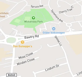
map for Wickersley Neighbourhood Group

Near Wickersley Neighbourhood …

  1. Catering Services
  2. 0.6 miles ★★★★★The Lings Monday Group, S661TY
  3. 1.0 mile ★★★★Mack Opco Ltd., S661YY
  4. 1.7 miles ★★★★★Herringthorpe United Reformed Church, S604JN
  5. 1.8 miles ★★★★★Friends of Dalton & East Herringthorpe & Thrybergh Green Spaces, S654DB
  6. 1.8 miles ★★★★★Dorothy Taylor Community Centre, S654HP
  7. 1.9 miles St. Marys Church, S653BA
  8. 2.1 miles ★★★★★Dalton Parish Hall, S653EW
  9. 2.2 miles Whiston Methodist Church, S604HN
  10. Restaurants & Cafés
  11. ★★★★★Winthrop Gardens, S661JJ
  12. School Food Ratings
  13. 0.1 miles ★★★★★Breakfast Club Wickersley Kids' Club, S661EU
  14. Chemists
  15. 0.1 miles Wickersley Pharmacy, S661EU
  16. 0.1 miles Well, S662JQ
  17. Doctors
  18. 0.1 miles Dr Clarke & Partners, S662JQ
  19. 0.1 miles Morthen Road Surgery, S661EU
  20. 0.1 miles Wickersley Health Centre, S662JQ
  21. 0.1 miles Morthen Road Surgery, S661EU
  22. Schools Primary
  23. 0.1 miles St Alban's CofE (Aided) Primary School, S661EU (249 pupils)
  24. 0.3 miles Wickersley Northfield Primary School, S662HL (443 pupils)
  25. 0.5 miles Bramley Sunnyside Infant School, S663QW (276 pupils)
  26. 0.5 miles Bramley Sunnyside Junior School, S663QW (325 pupils)
  27. Schools Secondary
  28. 0.2 miles Wickersley School and Sports College, S661JL (2050 pupils)