BLOCLEats

Wincanton Community Hospital (formerly Verrington)

Dancing Lane
Wincanton
Somerset
BA99DQ

Food rating: ★★★★★ 5/5 stars
Updated: 14. September 2023

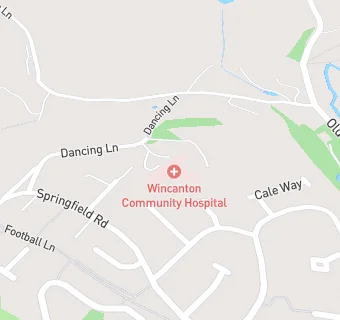
map for Wincanton Community Hospital (formerly Verrington)

Near Wincanton Community …

  1. Care Facilities
  2. 2.1 miles★★★★★Ellie Group Ltd, BA98EA
  3. 3.8 miles★★★★★Ladybird Pre-School, BA100EX
  4. 3.9 milesBourton and Zeals Pre-school, SP85FG
  5. 4.1 miles★★★★Community Kids Playgroup, BA100DP
  6. 4.7 miles★★★★★Voyage Care at Blackberry Hill, BA77HG
  7. 4.8 miles★★★★★The Toybox Pre-School, BA77JJ
  8. 5.6 miles★★★★★Explorers Pre School, BA80QD
  9. 5.9 miles★★★★★Salutemcare, SP84RE
  10. Bars & Nightclubs
  11. 0.2 miles★★★★★The Wagtail, BA98AA
  12. Restaurants & Cafés
  13. 0.3 miles★★★★★River Cale Cafe, BA99ED
  14. 0.4 miles★★★★★Cafe Central, BA99JB
  15. Retail Stores
  16. 0.4 miles★★★★★Wincanton Fruit and Veg, BA99JP
  17. Supermarkets
  18. 0.4 miles★★★★★Co-op, BA99JB
  19. School Food Ratings
  20. 0.4 miles★★★★★Our Lady of Mt Carmel Catholic Primary School, BA99DH
  21. Dentists
  22. 0.4 milesThe Wincanton Smile Centre, BA99JJ
  23. Doctors
  24. 0.4 milesWincanton Health Centre, BA99FQ
  25. Schools
  26. 2.1 milesMarchant Holliday School, BA80AH (49 pupils)
  27. Schools Primary
  28. 0.4 milesOur Lady of Mount Carmel Catholic Primary, BA99DH (125 pupils)
  29. 0.5 milesWincanton Primary School, BA99EL (391 pupils)
  30. 2.9 milesHorsington Church School, BA80BW (89 pupils)
  31. Schools Secondary
  32. 0.3 milesKing Arthur's School, BA99BX (468 pupils)

See all Care Facilities in Wincanton.