- Blocl
- Schools
- Nottinghamshire
- Bilsthorpe
Bilsthorpe Junior School
closed
31. August 1996
redirecting to
Crompton View Primary School
Your feedback +
Primary —
Community school
- URN
- 122618
- Education phase
- Primary
- Establishment type
- Community school
- Establishment #
- 2688
- Close date
- 31. August 1996
- OSGB coordinates
- Easting: 464843, Northing: 360640
- GPS coordinates
- Latitude: 53.139, Longitude: -1.0321
- Accepting pupils
- 7—11 years old
- Boarders
- No boarders
- Region › Const. › Ward
- East Midlands › Sherwood › Bilsthorpe
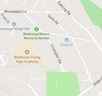
Schools nearby
- Bilsthorpe Junior School,
NG228PS
- Bilsthorpe Infant School,
NG228PS
-
0.1
miles Crompton View Primary School,
NG228PS
-
0.1
miles Bilsthorpe Flying High Academy,
NG228PS
(208 pupils)
-
2.3
miles Farnsfield Walter d'Ayncourt Community School,
NG228JZ
-
2.3
miles Farnsfield St Michael's Church of England Primary (Voluntary Aided) School,
NG228JZ
(264 pupils)
-
2.3
miles Farnsfield St Michael's Church of England Primary School,
NG228JZ
(278 pupils)
-
2.5
miles Farnsfield CofE Aided Primary School,
NG228EF
-
2.7
miles Kirklington Primary School,
NG228NG
(98 pupils)
-
2.7
miles Rodney School,
NG228NB
-
2.7
miles Wings School Notts,
NG228NB
(34 pupils)
-
3.5
miles Python Hill Junior School,
NG210JZ
-
3.5
miles Python Hill Infant School,
NG210JZ
-
3.5
miles Python Hill Primary School,
NG210JZ
(326 pupils)
-
3.5
miles The Python Hill Academy,
NG210JZ
(321 pupils)
-
3.7
miles Wellow House School,
NG220EA
(178 pupils)
-
4
miles Samuel Barlow Primary and Nursery Academy,
NG219DF
(273 pupils)
-
4
miles King Edwin Primary and Nursery School,
NG219NS
(463 pupils)
-
4
miles Samuel Barlow Primary Academy,
NG219DF
(279 pupils)
-
4.1
miles Lake View Primary and Nursery School,
NG210DU
(214 pupils)
-
4.1
miles Joseph Whitaker School,
NG210AG
-
4.1
miles The Joseph Whitaker School,
NG210AG
(1370 pupils)
-
4.2
miles Kneesall CofE Primary School,
NG220AB
(109 pupils)
-
4.2
miles The Rufford School,
NG219NP
-
4.2
miles Edgehill School,
NG220BE
🚸
schools in Bilsthorpe