Brecon Road Infants School closed 1. September 2014
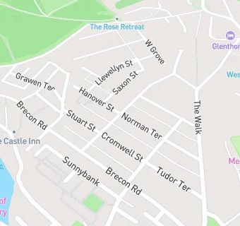
Brecon Road Infants School
Norman Terrace
Merthyr Tydfil
Merthyr Tydfil
Wales
CF478SDMerthyr Tydfil
Wales
Welsh establishment
- URN
- 401271
- Establishment type
- Welsh establishment
- Establishment #
- 2005
- Close date
- 1. September 2014
- Reason closed
- Closure
- OSGB coordinates
- Easting: 304712, Northing: 206812
- GPS coordinates
- Latitude: 51.752, Longitude: -3.3818
- Region › Const. › Ward
- Wales › Merthyr Tydfil and Rhymney › Park