Broom Leys School closed - academy converter 31. October 2012
redirecting to
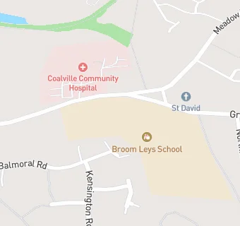
Broom Leys School
Broom Leys School
Broom Leys Road
Coalville
Leicestershire
England
LE674DBLeicestershire
England
👨🏫 headteacher: Mr Robert Prior
Primary — Community school
- URN
- 120085
- Education phase
- Primary
- Establishment type
- Community school
- Establishment #
- 2360
- Close date
- 31. October 2012
- Reason closed
- Academy Converter
- OSGB coordinates
- Easting: 444212, Northing: 314086
- GPS coordinates
- Latitude: 52.723, Longitude: -1.3468
- Accepting pupils
- 4—11 years old
- Boarders
- No boarders
- Region › Const. › Ward
- East Midlands › North West Leicestershire › Coalville East