BLOCLSchools

Churchfields High School closed 30. August 2001

Churchfields High School
Church Vale
West Bromwich
West Midlands
England
B714DR

👨‍🏫 headteacher: Mr J L Williams


Secondary — Community school

Admissions policy
Non-selective
URN
104004
Education phase
Secondary
Establishment type
Community school
Establishment #
4011
Close date
30. August 2001
Reason closed
Closure
OSGB coordinates
Easting: 401022, Northing: 292666
GPS coordinates
Latitude: 52.532, Longitude: -1.9864
Accepting pupils
11—18 years old
Boarders
No boarders
Region › Const. › Ward
West Midlands › West Bromwich East › West Bromwich Central
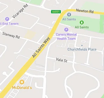
map for Churchfields High School

Near Churchfields High …

  1. Schools Secondary
  2. 0.6 milesThe Phoenix Collegiate, B712BX (1937 pupils)
  3. 0.7 milesShireland CBSO Academy, B708SZ (146 pupils)
  4. 0.9 milesShireland Biomedical Utc, B708DJ (316 pupils)
  5. Schools
  6. 0.8 milesSandwell Community School, B712JN (92 pupils)
  7. 1.0 mileThe British Muslim School, B708NX (76 pupils)
  8. Schools Primary
  9. 0.1 milesSt Mary Magdalene CofE Voluntary Controlled Primary School, B711RP (238 pupils)
  10. 0.3 milesAll Saints CofE Primary School, B711QN (458 pupils)
  11. 0.3 milesEaton Valley Primary School, B714BU (463 pupils)
  12. 0.6 milesHargate Primary School, B711PG (492 pupils)
  13. 0.7 milesPennyhill Primary School, B713BU (672 pupils)
  14. 0.8 milesSt John Bosco Catholic Primary School, B712ST (251 pupils)
  15. 0.9 milesKing George V Primary School, B706JA (235 pupils)
  16. 0.9 milesHateley Heath Academy, B712RP (424 pupils)
  17. 1.0 mileHall Green Primary School, B712JQ (464 pupils)
  18. 1.0 mileMoorlands Primary School, B712NZ (209 pupils)
  19. Care Facilities
  20. 0.1 miles★★★★★Little Peoples House, B711RU
  21. 0.2 miles★★★★★Happy Valley Pre-School Ltd, B711QS
  22. 0.2 miles★★★★★Churchfield Court Care Home, B711RR
  23. Chemists
  24. 0.1 milesSandwell Pharmacy, B714DH
  25. Doctors
  26. 0.1 milesLyndon Health Centre, B714DL
  27. Catering Services
  28. 0.2 miles★★★★★West Bromwich Community Centre, B711QS
  29. Bars & Nightclubs
  30. 0.1 miles★★★★★The Red Lion, B711RH
  31. Restaurants & Cafés
  32. 0.1 miles★★★★★McDonalds Restaurants Ltd, B711RG
  33. Retail Stores
  34. 0.1 miles★★Uppals News & Booze, B714DL
  35. School Food Ratings
  36. 0.1 miles★★★★★St Mary Magdalene C of E School, B711RP
  37. 0.2 miles★★★★★Pennyhill Primary School, B713DJ
  38. Takeaway Shops
  39. 0.1 miles★★★★★Subway Midlands Limited, B714DL
  40. 0.1 miles★★★★★Miss Li Kitchen, B714DL
  41. 0.1 milesSimon's Fish And Chips, B714DL
  42. 0.1 miles★★★Ciao Italia, B714DL

See all schools in West Bromwich