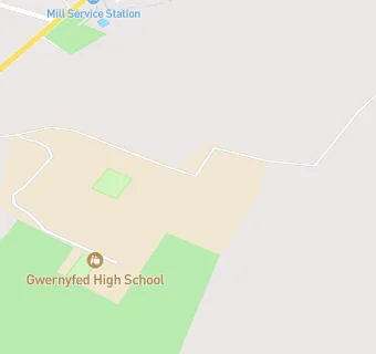
Near Gwernyfed High …
- Schools
- 2.5 milesYsgol y Mynydd Du, LD30DQ
- 2.8 milesTy Bronllys, LD30LU
- 3.0 milesArchdeacon Griffiths C.I.W. Primary School, LD30YB
- 4.1 milesClyro C.I.W. School, HR35LE
- 4.5 milesHay-On-Wye C.P. School, HR35BT
- 6.6 milesLlangors V.P. School, LD37UB
- 9.2 milesYsgol y Bannau, LD39SR
- 9.3 milesBrecon High School, LD39SR
- 9.6 milesYsgol Golwg Pen y Fan, LD37LU
- 9.6 milesPriory C.I.W. School, LD39EU
- 9.9 milesChrist College, LD38AF
- 9.9 milesYsgol Penmaes, LD37HL
- 10.2 milesLlanfaes C.P. School, LD38EB
- Schools Primary
- 7.3 milesClifford Primary School, HR35HA (98 pupils)
- 8.4 milesMichaelchurch Escley Primary School, HR20PT (54 pupils)
- Farmers
- 0.8 miles★★★★Primrose Organic Farm, LD30ST
- Hotels & BnBs
- 1.0 mile★★★★★The Living Energy, LD30TB
- 1.3 miles★★★★★Woodlands Outdoor Education Centre, HR35LP
- Food Trucks
- 0.3 milesJames Rees Catering, LD30SL
- Catering Services
- 0.1 miles★★★★Gwernyfed Walled Garden, LD30SG
- 1.0 mile★★★★★Beeton for Time, LD30TB
- Bars & Nightclubs
- 0.3 miles★★★★★Old Barn Inn, LD30SL
- 1.2 miles★★★★★Foyles of Glasbury, HR35LH
- 1.3 miles★★★★★The Harp Inn, HR35NR
- 1.3 miles★★★★★SOBREMESA Drinks - Tap Room, LD30DL
- Restaurants & Cafés
- 0.3 miles★★★★★Three Cocks Hotel, LD3OSL
- 1.2 miles★★★★★The River Wye Activity Centre, HR35NW
- Retail Stores
- 0.3 miles★★★★★Antur Brew Company, LD30SL
- 1.3 miles★★★★★Glasbury Motors (Shop), HR35NP
- School Food Ratings
- 0.1 miles★★★★★Gwernyfed High School, LD30SG
See all schools in Talgarth
