Near Highfield School
- Schools
- 0.2 milesThe Avenue Pre-Preparatory School and Nursery, N65RX (78 pupils)
- 0.3 milesHighgate School, N64AY (1942 pupils)
- 0.4 milesThe Harington Scheme Ltd, N65AD
- 0.5 milesChanning School, N65HF (1028 pupils)
- 0.6 milesTreeHouse School, N103JA (100 pupils)
- Schools Primary
- 0.3 milesHighgate Primary School, N64ED (433 pupils)
- 0.3 milesSt Michael's CofE Voluntary Aided Primary School, N64BG (427 pupils)
- 0.6 milesSt James Church of England Primary School, N103JA (182 pupils)
- 0.7 milesWhitehall Park School, N65EP (242 pupils)
- 0.7 milesSt Joseph's Catholic Primary School, N195NE (433 pupils)
- 0.8 milesTetherdown Primary School, N103BP (402 pupils)
- 0.9 milesColeridge Primary School, N88DN (870 pupils)
- Schools Secondary
- 0.7 milesHighgate Wood Secondary School, N88RN (1554 pupils)
- 0.7 milesSt Aloysius RC College, N65LY (397 pupils)
- 1.0 mileCity of London Academy, Highgate Hill, N193EU (662 pupils)
- Chemists
- 0.1 milesHayward Pharmacy, N64EJ
- Dentists
- 0.1 milesN6 Dental, N64ER
- Doctors
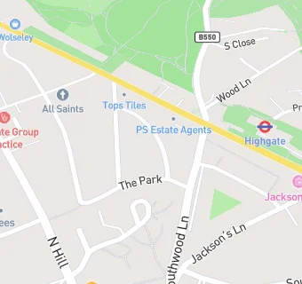
- 0.1 milesHighgate Group Practice, N64QA
- 0.1 milesHighgate Group Practice, N64QA
- Bars & Nightclubs
- 0.1 miles★★★★★The Highgate Inn, N64ER
- Restaurants & Cafés
- 0.1 miles★★★★★Be'La Cafe, N65AA
- 0.1 miles★★★Highgate Cafe, N65AA
- 0.1 miles★★★★★A La Mesa ltd, N65AA
- 0.1 miles★★★★★Laylas Kitchen Limited, N65AA
- 0.1 miles★★★★★Food Room 305, N65AA
- 0.1 miles★★★★★Creativity plus, N64EJ
- Retail Stores
- ★★★★Vince's Local, N65TA
- 0.1 milesHops 'N' Pops Wine Merchant, N64ER
- Takeaway Shops
- 0.1 miles★★★★★The Tiffin Guru Ltd, N64EJ
- 0.1 miles★★★★Mega Grill, N64EJ
See all schools in London