BLOCLSchools

Howell's Preparatory School closed

Howell's Preparatory School
Park Street
Denbigh
Wales
LL163EN

Your feedback   +


Welsh establishment

URN
401978
Establishment type
Welsh establishment
Establishment #
6039
OSGB coordinates
Easting: 305566, Northing: 366073
GPS coordinates
Latitude: 53.183, Longitude: -3.4146
Region › Const. › Ward
Wales › Vale of Clwyd › Denbigh Central
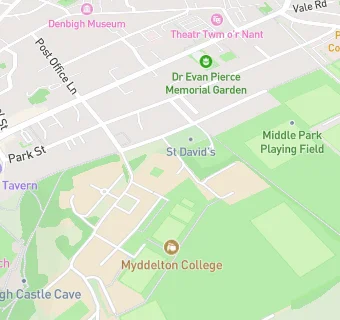
map for Howell's Preparatory School

Schools nearby

  1. Howell's Preparatory School, LL163EN
  2. 0.3 miles Denbigh High School, LL163EX
  3. 0.3 miles Howell's School, LL163LN
  4. 0.4 miles Ysgol Twm o'r Nant, LL163DP
  5. 0.4 miles Ysgol Y Parc Infants, LL163ER
  6. 0.5 miles Ysgol Frongoch, LL163DP
  7. 0.6 miles Ysgol Plas Brondyffryn, LL163DR
  8. 0.7 miles Gwaenynog Infants C.P. School, LL163RU
  9. 0.8 miles Heulfre Junior School, LL163RU
  10. 1.3 miles St Brigid's School, LL164BH
  11. 1.3 miles St Brigid's School, LL164BH
  12. 2.2 miles Ysgol Gymraeg Henllan, LL165AW
  13. 2.3 miles Ysgol Bro Cinmeirch, LL164NL
  14. 2.8 miles Ysgol Trefnant, LL165UF
  15. 2.8 miles Ysgol Pant Pastynog, LL164SG
  16. 2.8 miles Ysgol Trefnant, LL165UF
  17. 3.2 miles Ysgol Bryn Clwyd, LL164EY
  18. 3.4 miles Bodfari C.P. School, LL164DA
  19. 3.9 miles Ysgol Gynradd Rhydgaled, LL165SD
  20. 4.5 miles Gellifor C.P. School, LL151SG
  21. 4.6 miles Ysgol Tremeirchion, LL170UN
  22. 4.8 miles Rhewl C.P. School, LL152TU
  23. 5.1 miles Ysgol Uwchradd Glan Clwyd, LL170RP
  24. 5.2 miles Ysgol Cyffylliog, LL152DL
  25. 5.2 miles St Asaph V.P. Infants, LL170RL

🚸 schools in Denbigh