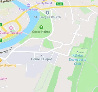
Near Kendal Centre
- Schools
- 0.3 milesSouth Lakes Academy, LA94ED (10 pupils)
- 0.4 milesSandgate School, LA96JG (116 pupils)
- 0.9 milesCambian Whinfell School, LA95EZ (11 pupils)
- Schools 16 Plus
- 0.7 milesKendal College, LA95AY
- Schools Nursery
- 0.6 milesKendal Nursery School, LA94PH (87 pupils)
- Schools Primary
- 0.3 milesStramongate Primary School, LA94BT (278 pupils)
- 0.6 milesCastle Park School, LA96BE (322 pupils)
- 0.6 milesGhyllside Primary School, LA94JB (451 pupils)
- 0.7 milesHeron Hill Primary School, LA97JH (448 pupils)
- 0.8 milesVicarage Park CofE Primary School, LA95BP (99 pupils)
- 0.8 milesDean Gibson Catholic Primary School, Kendal, LA95HB (164 pupils)
- 0.9 milesSt Thomas's CofE Primary School, LA95PP (222 pupils)
- 2.0 milesSt Oswald's CofE Primary School, LA96QR (97 pupils)
- Schools Secondary
- 0.7 milesKirkbie Kendal School, LA97EQ (1055 pupils)
- 0.9 milesThe Queen Katherine School, LA96PJ (936 pupils)
- Dentists
- 0.3 milesDental Angel Practice, LA94ED
- Catering Services
- 0.2 milesKendal Sea Cadets, LA97DG
- 0.2 milesSt Georges Church, LA97AS
- Bars & Nightclubs
- 0.2 miles★★★★★Castle Inn (Kendal) Ltd, LA97AA
- 0.2 miles★★★★★The Barrel House, LA97DF
- Restaurants & Cafés
- ★★★★★Kendal Snowsports Club, LA97BY
- 0.1 miles★★★★★Space2Create, LA97DE
- 0.2 miles★★★★★Castle Street Centre, LA97AD
- 0.2 miles★★★★★The Factory Tap, LA97DE
- 0.2 milesChef & Barrel, LA97DE
- 0.2 miles★★★★★The Garden Cafe & Takeaway, LA94BH
- 0.2 miles★★★★★The Bakestone, LA95AJ
- 0.2 miles★★★★★The Joshua Tree, LA94BH
- 0.3 miles★★★★★AJ's, LA94LR
- Retail Stores
- 0.3 miles★★★★★Waste into Wellbeing, LA94PU
See all schools in Kendal
