BLOCLSchools

Kidsgrove Sixth Form closed 31. August 2006

Clough Hall Technology School Sixth Form Centre School
Maryhill High School Sixth Form Centre School

Kidsgrove Sixth Form
First Avenue
Kidsgrove
Kidsgrove
Staffordshire
England
ST71DP


Sixth form centres

URN
132950
Establishment type
Sixth form centres
Establishment #
4902
Open date
26. October 1995
Close date
31. August 2006
Reason closed
Closure
OSGB coordinates
Easting: 383632, Northing: 354210
GPS coordinates
Latitude: 53.085, Longitude: -2.2458
Accepting pupils
16—18 years old
Region › Const. › Ward
West Midlands › Stoke-on-Trent North › Kidsgrove & Ravenscliffe
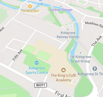
map for Kidsgrove Sixth Form

Near Kidsgrove Sixth …

  1. Schools
  2. 0.4 milesBluebell School Ltd, ST71EH (116 pupils)
  3. Schools Primary
  4. 0.2 milesSt John the Evangelist Catholic Primary, ST71EL (199 pupils)
  5. 0.4 milesSt Thomas' CofE Primary Academy, ST74HT (172 pupils)
  6. 0.5 milesDove Bank Primary School, ST74AP (173 pupils)
  7. 0.5 milesThe Reginald Mitchell Primary School, ST71NA (192 pupils)
  8. 0.7 milesSt Saviour's CofE Academy, ST71LW (187 pupils)
  9. 0.8 milesKidsgrove Primary School, ST74DL (157 pupils)
  10. 1.1 milesGoldenhill Primary Academy, ST64QE (229 pupils)
  11. 1.1 milesSpringhead Primary School, ST71RA (195 pupils)
  12. 1.4 milesStar Academy, Sandyford, ST65PT (182 pupils)
  13. 1.5 milesSt Joseph's Catholic Academy, Goldenhill, ST65RN (241 pupils)
  14. 1.7 milesThursfield Primary School, ST74JL (280 pupils)
  15. 1.7 milesScholar Green Primary School, ST73HF (225 pupils)
  16. Schools Secondary
  17. The King's CofE Academy, ST71DP (765 pupils)
  18. 0.8 milesKidsgrove Secondary School, ST74DL (300 pupils)
  19. Dentists
  20. 0.3 milesKidsgrove Dental Practice, ST74EW
  21. 0.3 milesKidsgrove Bank Dental Surgery, ST74EH
  22. Food Trucks
  23. 0.3 miles★★★★★DESSERT DELIGHTS, ST71EF
  24. 0.3 miles★★★★★TRULY SCRUMPTIOUS, ST71EF
  25. 0.3 milesCHRISTMAS CRUMBLE, ST71EF
  26. Catering Services
  27. 0.1 miles1ST KIDSGROVE SCOUT HALL, ST71AQ
  28. 0.1 miles★★★★★ST THOMAS CHURCH (THE WADE CENTRE), ST71AG
  29. Bars & Nightclubs
  30. 0.1 miles★★★★CLOUGH HALL HOTEL, ST71AN
  31. 0.2 miles★★★★★KIDSGROVE CRICKET CLUB, ST71AN
  32. 0.2 miles★★★★★RAILWAY INN, ST71EA
  33. 0.3 miles★★★★★THE VICTORIA TAP ROOM, ST74EL
  34. Retail Stores
  35. 0.1 miles★★★★★NEWCASTLE STAFFS FOODBANK, ST71AG
  36. 0.2 milesKIDSGROVE LIBRARY, ST71BS
  37. 0.2 miles★★★★★PARK STORES, ST71AN
  38. Supermarkets
  39. 0.3 miles★★★★★TESCO, ST71DX

See all schools in Kidsgrove