- Blocl
- Schools
- Rhondda Cynon Taf
- Ferndale
Maerdy Junior School
closed
1. September 2010
Your feedback +
Welsh establishment
- URN
- 401188
- Establishment type
- Welsh establishment
- Establishment #
- 2152
- Close date
- 1. September 2010
- Reason closed
- Closure
- OSGB coordinates
- Easting: 297786, Northing: 197806
- GPS coordinates
- Latitude: 51.670, Longitude: -3.4794
- Region › Const. › Ward
- Wales › Rhondda › Maerdy
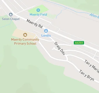
Schools nearby
- Maerdy Junior School,
CF434TW
-
0.3
miles Ferndale Community School,
CF434AR
-
0.4
miles Maerdy Infants School,
CF434DN
-
1.1
miles Pentre Primary School,
CF417DG
-
1.2
miles Blaenllechau Infant School,
CF434PA
-
1.2
miles Treorchy Primary School,
CF426SA
-
1.3
miles Treorchy Youth Centre,
CF426RU
-
1.4
miles Darran Park Primary School,
CF434LE
-
1.4
miles Ferndale Infants School,
CF434PS
-
1.5
miles Ton Pentre Junior School,
CF417EL
-
1.5
miles Y.G.G. Llyn-y-Forwyn,
CF434LG
-
1.5
miles Treorchy Comprehensive School,
CF426UL
-
1.6
miles Glynhafod Nursery School,
CF446LD
-
1.6
miles Glynhafod Junior School,
CF446LD
-
1.6
miles Cwmaman Primary,
CF446LA
-
1.7
miles Bodringallt Primary School,
CF417QE
-
1.7
miles Gelli Primary School,
CF417PX
-
1.7
miles Ton Infants School,
CF417LS
-
1.7
miles Ynyswen Infant School,
CF382DH
-
1.7
miles Bodringallt Tuition Group,
CF417QE
-
1.8
miles Ysgol G.G. Ynyswen,
CF426ED
-
1.8
miles Ysgol G.G. Bodringallt,
CF417RX
-
1.9
miles Parc Primary School,
CF426LY
-
1.9
miles Ysgol G.G. Bronllwyn,
CF417NW
-
2
miles Cwmaman Infants School,
CF446NS
🚸
schools in Ferndale