BLOCLSchools

Mayals Primary School

Mayals Primary School
Fairwood Road
West Cross
Newcastle Emlyn
Wales
SA35JP

📞 phone: 01792 402755


Welsh establishment

URN
400895
Establishment type
Welsh establishment
Establishment #
2076
OSGB coordinates
Easting: 260857, Northing: 189984
GPS coordinates
Latitude: 51.591, Longitude: -4.0100
Region › Const. › Ward
Wales › Gower › West Cross
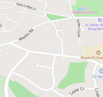
map for Mayals Primary School

Near Mayals Primary …

  1. Schools
  2. 0.4 milesT? Dan Y Coed, SA35AL
  3. 0.5 milesY.G.G. Llwynderw, SA35LS
  4. 0.6 milesSt David's Catholic Primary School, SA35TS
  5. 0.6 milesGrange Primary School, SA35TS
  6. 0.7 milesWhitestone Primary School, SA35RF
  7. 1.1 milesNewton Primary School, SA34UE
  8. 1.1 milesOystermouth Primary School, SA34BE
  9. 1.7 milesParkland Primary School, SA28NG
  10. 1.7 milesCila Primary School, SA27DR
  11. 1.8 milesBishopston Comprehensive School, SA33JP
  12. 1.9 milesBishopston Primary School, SA33EN
  13. 1.9 milesOlchfa School, SA27AB
  14. 1.9 milesBishop Gore School, SA29AP
  15. 2.1 milesHendrefoilan Primary School, SA27LF
  16. 2.2 milesBrynmill Primary School, SA20BU
  17. Care Facilities
  18. 0.6 miles★★★★Child's Play at ltd, SA35TS
  19. Catering Services
  20. 0.2 miles★★★★★RVS West Cross Luncheon Club, SA35LE
  21. 0.4 milesWest Cross Pantry, SA35LP
  22. 0.7 miles★★★★★Cylch Meithrin Mwmbwls, SA35AS
  23. Bars & Nightclubs
  24. 0.6 miles★★★★The West Cross Inn, SA35AB
  25. Restaurants & Cafés
  26. 0.4 miles★★★★★TA Centre, SA35AD
  27. 0.7 miles★★★★The Junction, SA35AS
  28. Retail Stores
  29. 0.7 miles★★★★Mumbles Service Station and Subway, SA35AS
  30. School Food Ratings
  31. ★★★★★Mayals Primary School, SA35JP
  32. ★★★★★Mayals Wrap Around, SA35JP
  33. 0.5 miles★★★★★Dan Y Coed School, SA35AL
  34. 0.5 miles★★★★★Mes Llwynderw, SA35LS
  35. 0.5 miles★★★★★YGG Llwynderw, SA35LS
  36. 0.7 miles★★★★Whitestone Primary After School Club, SA35RF
  37. 0.7 miles★★★★★Grange & St David's RC Primary School, SA35TS

See all schools in Newcastle Emlyn