BLOCLSchools

Menston Infant School closed 31. August 1987

Menston Infant School
Main Street
Menston
Yeadon
West Yorkshire
England
LS296LF

Your feedback   +


Primary — Community school

URN
127736
Education phase
Primary
Establishment type
Community school
Establishment #
2158
Close date
31. August 1987
OSGB coordinates
Easting: 417077, Northing: 443697
GPS coordinates
Latitude: 53.889, Longitude: -1.7417
Accepting pupils
5—7 years old
Boarders
No boarders
Region › Const. › Ward
Yorkshire and the Humber › Shipley › Wharfedale
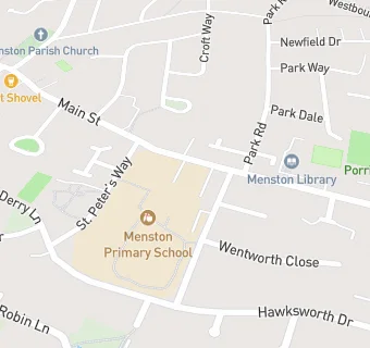
map for Menston Infant School

Schools nearby

  1. Menston Junior School, LS296LF
  2. Menston Infant School, LS296LF
  3. 0.1 miles Menston Primary School, LS296NY (404 pupils)
  4. 0.5 miles Linton House Adolescent Unit, NG323EP
  5. 0.8 miles St Mary's Catholic Comprehensive School, Menston, LS296AE
  6. 0.8 miles St. Mary's Menston, a Catholic Voluntary Academy, LS296AE (1260 pupils)
  7. 1.2 miles Burley and Woodhead CofE Primary School, LS297RQ (206 pupils)
  8. 1.2 miles Hawksworth Church of England Primary School, LS208NX (104 pupils)
  9. 1.2 miles Hawksworth Hall School, LS208NU
  10. 1.2 miles Tranfield School, LS208LS
  11. 1.3 miles The North West Silc, LS208PP
  12. 1.3 miles Two Dales School, LS208PP
  13. 1.3 miles Green Meadows Academy, LS208LS (211 pupils)
  14. 1.4 miles Tranmere Park Primary School, LS208JJ (318 pupils)
  15. 1.5 miles Burley Middle School, LS297EJ
  16. 1.5 miles Guiseley Primary School, LS209DA (467 pupils)
  17. 1.5 miles Guiseley Nursery School, LS209DA
  18. 1.5 miles Burley Oaks Primary School, LS297EJ (412 pupils)
  19. 1.6 miles Guiseley School, LS208DT (1366 pupils)
  20. 1.7 miles Burley CofE First School, LS297JY
  21. 1.8 miles Westgate Primary School, LS213JS (244 pupils)
  22. 1.8 miles St. Oswald's CofE Primary School, LS209BT (377 pupils)
  23. 1.8 miles Westgate First School, LS213JS
  24. 2.1 miles Ashfield Primary School, LS212DF (230 pupils)
  25. 2.1 miles Ashfield School, LS212DF

🚸 schools in Yeadon