Be LocalSchools / Derbyshire / Chesterfield

North Wingfield Infant School closed - result of amalgamation/merger 31. March 2007

redirecting to 
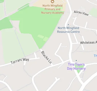
North Wingfield Primary and Nursery School

North Wingfield Infant School
Blacks Lane
North Wingfield
Chesterfield
Derbyshire
England
S425LW

👩‍🏫 acting headteacher: Mrs Dorcas Jennings


Primary — Community school

URN
112769
Education phase
Primary
Establishment type
Community school
Establishment #
2504
Close date
31. March 2007
Reason closed
Result of Amalgamation/Merger
OSGB coordinates
Easting: 440890, Northing: 365263
GPS coordinates
Latitude: 53.183, Longitude: -1.3896
Accepting pupils
3—7 years old
Boarders
No boarders
Region › Const. › Ward
East Midlands › North East Derbyshire › North Wingfield Central
map for North Wingfield Infant School

Near North Wingfield …

  1. Schools Primary
  2. 0.3 milesNorth Wingfield Primary and Nursery Academy, S425LE (360 pupils)
  3. 1.0 mileGrassmoor Primary School, S425EP (238 pupils)
  4. 1.0 mileTupton Primary and Nursery Academy, S426DY (239 pupils)
  5. 1.1 milesPark House Primary School, S458DB (207 pupils)
  6. 1.4 milesSharley Park Community Primary School, S459BN (402 pupils)
  7. 1.7 milesTemple Normanton Junior Academy, S425DW (101 pupils)
  8. 2.0 milesHolmgate Primary School and Nursery, S459QD (238 pupils)
  9. 2.0 milesHeath Primary School, S445RH (356 pupils)
  10. 2.1 milesHunloke Park Primary School, S426PT (290 pupils)
  11. 2.2 milesPilsley Primary School, S458EU (210 pupils)
  12. 2.4 milesDeer Park Primary School, S426TD (340 pupils)
  13. 2.4 milesHasland Junior School, S410LY (376 pupils)
  14. Schools
  15. 2.6 milesEsteem North Academy, S410LN (228 pupils)
  16. Schools Secondary
  17. 0.8 milesTupton Hall School, S426LG (1637 pupils)
  18. 2.5 milesOutwood Academy Hasland Hall, S410LP (820 pupils)
  19. Care Facilities
  20. 0.1 miles★★★★★Kids Planet North Wingfield, Chesterfield, S425LQ
  21. 0.2 miles★★★★★Claydon Lodge Care Home, S425LY
  22. 0.2 miles★★★★★Clowns Early Years Centre, S425XA
  23. Chemists
  24. 0.1 milesPeak Pharmacy, S425LQ
  25. Doctors
  26. 0.1 milesNorth Wingfield Medical Centre, S425ND
  27. 0.1 milesNorth Wingfield Medical Centre, S425ND
  28. 0.2 milesSt Lawrence Road Surgery, S425LH
  29. 0.2 milesSt Lawrence Road Surgery, S425LH
  30. Bars & Nightclubs
  31. 0.2 miles★★★★★White Hart, S425LH
  32. Restaurants & Cafés
  33. 0.2 miles★★★★North Wingfield Community Resource Centre, S425PW
  34. Retail Stores
  35. 0.1 miles★★★★★Slimming World, S425UU
  36. 0.1 miles★★★Go Local Extra, S425LQ
  37. 0.1 milesPeak Pharmacy, S425LQ
  38. Supermarkets
  39. 0.3 miles★★★★★Central England Co-operative Ltd, S425PD
  40. Takeaway Shops
  41. 0.2 miles★★★★Va Kei, S425NF

See all schools in Chesterfield