BLOCLSchools

Ray Lodge Infants' School closed 1. September 1997

redirecting to Ray Lodge Primary School

Ray Lodge Infants' School
Snakes Lane East
London
Essex
England
IG87JQ

Your feedback   +


Primary — Community school

URN
102829
Education phase
Primary
Establishment type
Community school
Establishment #
2050
Close date
1. September 1997
OSGB coordinates
Easting: 541651, Northing: 191695
GPS coordinates
Latitude: 51.606, Longitude: 0.044110
Accepting pupils
5—7 years old
Boarders
No boarders
Region › Const. › Ward
London › Ilford North › Bridge
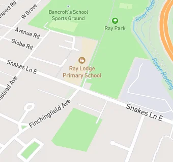
map for Ray Lodge Infants' School

Schools nearby

  1. Ray Lodge Junior School, IG87JQ
  2. Ray Lodge Infants' School, IG87JQ
  3. 0.1 miles Ray Lodge Primary School, IG87JQ (638 pupils)
  4. 0.1 miles Ray Lodge Primary School, IG87JQ (672 pupils)
  5. 0.5 miles Roding Primary School, IG88NP (431 pupils)
  6. 0.6 miles Woodbridge High School, IG87DQ (1879 pupils)
  7. 0.8 miles Woodford Green Preparatory School, IG80BZ (385 pupils)
  8. 0.9 miles West Hatch High School, IG75BT
  9. 0.9 miles St John's RC School (Essex), IG88AX (99 pupils)
  10. 0.9 miles Finnish Primary School London, IG88QJ
  11. 0.9 miles Sir Winston Churchill Secondary School, E182QZ
  12. 0.9 miles B A D Junior Conductive Education, CO65PD
  13. 0.9 miles West Hatch High School, IG75BT (1396 pupils)
  14. 0.9 miles Luxborough Court School, IG75AB
  15. 1 mile Glade Primary School, IG50PF (442 pupils)
  16. 1 mile Churchfields Infants' School, E182RB
  17. 1 mile Wells Primary School, IG80PP (348 pupils)
  18. 1 mile Avon House School, IG80PN (272 pupils)
  19. 1 mile Churchfields Infants' School, E182RB (448 pupils)
  20. 1.1 miles Churchfields Junior School, E182RB
  21. 1.1 miles Oakdale Junior School, E181JX (326 pupils)
  22. 1.1 miles Churchfields Junior School, E182RB (482 pupils)
  23. 1.1 miles Lilyvale, IG88HD
  24. 1.1 miles Stradbroke, IG50DL (2 pupils)
  25. 1.1 miles The Anderson School, IG75AB (54 pupils)

🚸 schools in London