BLOCLSchools

Spurley Hey School closed 31. December 1999

Spurley Hey School
Cranworth Road
Rotherham
South Yorkshire
England
S651LN

Your feedback   +


Secondary — Community school

URN
127634
Education phase
Secondary
Establishment type
Community school
Establishment #
4008
Close date
31. December 1999
Reason closed
Closure
OSGB coordinates
Easting: 443940, Northing: 393560
GPS coordinates
Latitude: 53.437, Longitude: -1.3400
Accepting pupils
11—16 years old
Boarders
No boarders
Region › Const. › Ward
Yorkshire and the Humber › Rotherham › Rotherham East
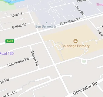
map for Spurley Hey School

Schools nearby

  1. Spurley Hey School, S651LN
  2. 0.1 miles Coleridge Primary School, S651LW
  3. 0.1 miles Coleridge Primary, S651LW (221 pupils)
  4. 0.2 miles East Dene Primary School, S652DF
  5. 0.2 miles East Dene Primary, S652DF (303 pupils)
  6. 0.3 miles St Ann's Junior School, S651PD
  7. 0.3 miles Clifton Community School, S652SN (797 pupils)
  8. 0.3 miles St Ann's Junior and Infant School, S651PD (367 pupils)
  9. 0.3 miles Eastwood Village Primary School, S651RD (204 pupils)
  10. 0.3 miles Clifton Community School, S652SN (949 pupils)
  11. 0.3 miles St Ann's Primary School, S651PD (330 pupils)
  12. 0.4 miles The Blenheim Centre, S651NN
  13. 0.4 miles St Ann's Infant School, S651PJ
  14. 0.6 miles RNN Group, S651EG
  15. 0.7 miles Arnold Nursery School and Children's Centre, S652LY (112 pupils)
  16. 0.7 miles Badsley Moor Junior School, S652QS
  17. 0.7 miles Badsley Primary School, S652QS (569 pupils)
  18. 0.8 miles High Greave Junior School, S653LZ
  19. 0.8 miles High Greave Infant School, S653LZ
  20. 0.8 miles High Greave Junior School, S653LZ (205 pupils)
  21. 0.8 miles High Greave Infant School, S653LZ (110 pupils)
  22. 0.9 miles St Mary's Catholic Primary School, S652NU
  23. 0.9 miles Rudston Preparatory School, S602SW
  24. 0.9 miles St Mary's Catholic Primary School, S652NU (203 pupils)
  25. 1 mile Broom Valley Infant School, S602QU

🚸 schools in Rotherham