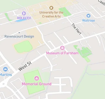
Near St Christopher's …
- Schools
- 0.3 milesUniversity for the Creative Arts, GU97DS
- 0.9 milesThe Ridgeway School, GU98HB (112 pupils)
- 0.9 milesThe Abbey School, GU98DY (145 pupils)
- 2.0 milesBarfield Prep School, GU101PB (284 pupils)
- Schools Primary
- 0.1 milesPotters Gate CofE Primary School, GU97BB (538 pupils)
- 0.2 milesSt Andrew's Church of England Infant School, GU97PW (89 pupils)
- 0.4 milesHighfield South Farnham School, GU98QH (473 pupils)
- 0.7 milesSt Polycarp's Catholic Primary School, GU98BQ (415 pupils)
- 0.9 milesSouth Farnham School, GU98DY (846 pupils)
- 1.1 milesSt Peter's CofE Primary School, GU98TF (419 pupils)
- 1.2 milesFolly Hill Infant Academy, GU90DB (74 pupils)
- 1.6 milesHale Nursery & Primary Academy, GU90LR (289 pupils)
- 1.8 milesWilliam Cobbett Primary School, GU99ER (467 pupils)
- Schools Secondary
- 0.8 milesWeydon School, GU98UG (1643 pupils)
- 1.6 milesFarnham Heath End, GU99BN (1092 pupils)
- Care Facilities
- 0.1 miles★★★★★Potters Gate Care Club, GU97BB
- 0.2 miles★★★Care Club, GU97PW
- Chemists
- 0.2 milesVaughan James Chemist, GU97HH
- Dentists
- Surrey Orthodontic Practices - Julian William Young, GU97EH
- Food Trucks
- ★★★Farnham Town FC Mystery Kitchen, GU97DY
- 0.1 miles★★★Farnham Town Football Club, GU97DY
- Catering Services
- 0.2 milesGolf Manor, GU97PY
- Bars & Nightclubs
- ★★★★★The Plough, GU97EH
- Restaurants & Cafés
- ★★★★★Farnham Tandoori, GU97DX
- ★★★Hungry Boys, GU97EH
- 0.1 miles★★★★★Caffe Piccolo, GU97EN
- 0.2 miles★★★★★Brightwells Gostrey, GU97EE
- 0.2 miles★★★★The Wine Yard, GU97HH
- Retail Stores
- ★★★★★West Street News, GU97EH
- School Food Ratings
- 0.1 miles★★★★★Caterlink @ Potters Gate C of E Prim, GU97BB
See all schools in Farnham
