BLOCLSchools

St George's School closed 1. January 2001
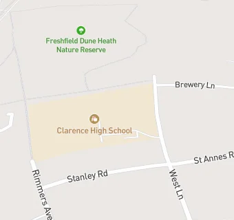
St George's School
West Lane
Freshfield
Formby
Formby
Merseyside
England
L377AZ


Secure units

URN
133059
Establishment type
Secure units
Establishment #
62
Close date
1. January 2001
OSGB coordinates
Easting: 329511, Northing: 408785
GPS coordinates
Latitude: 53.571, Longitude: -3.0659
Accepting pupils
5—16 years old
Boarders
No boarders
Region › Const. › Ward
North West › Sefton Central › Harington
map for St George's School

Near St George's …

  1. Schools
  2. 2.0 milesMerefield School, PR82QZ (103 pupils)
  3. Schools Primary
  4. 0.5 milesTrinity St Peter's CofE Primary School, L377EJ (245 pupils)
  5. 0.8 milesFreshfield Primary School, L373JT (279 pupils)
  6. 1.1 milesWoodlands Primary School, L372JN (363 pupils)
  7. 1.1 milesOur Lady of Compassion Catholic Primary School, L378BZ (244 pupils)
  8. 1.3 milesSt Jerome's Catholic Primary School, L372LX (201 pupils)
  9. 1.4 milesRedgate Community Primary School, L374EW (277 pupils)
  10. 1.5 milesSt Luke's Church of England Primary School, L372HW (366 pupils)
  11. 1.9 milesKings Meadow Primary School and Early Years Education Centre, PR83RS (210 pupils)
  12. 2.0 milesShoreside Primary School, PR82QZ (213 pupils)
  13. 2.4 milesAinsdale St John's Church of England Primary School, PR83JE
  14. 3.8 milesFarnborough Road Infant School, PR83DF (434 pupils)
  15. Schools Secondary
  16. 0.7 milesFormby High School, L373HW (1099 pupils)
  17. 1.9 milesRange High School, L372YN (1077 pupils)
  18. 3.3 milesBirkdale High School, PR83DT (936 pupils)
  19. Care Facilities
  20. 0.5 miles★★★★★Wrap Around Care, L377EJ
  21. Chemists
  22. 0.5 milesRyders Chemist Ltd, L373HJ
  23. Doctors
  24. 0.6 milesFreshfield Surgery, L373NU
  25. Catering Services
  26. 0.4 milesCaterquick, L377DB
  27. Bars & Nightclubs
  28. 0.2 miles★★★★★Freshfield Hotel, L377BD
  29. 0.4 miles★★★★★Formby Golf Club, L371LQ
  30. 0.4 miles★★★★★Beer Station, L377DB
  31. 0.5 miles★★★★★Grapes Hotel Formby - K-Town, Chik Box, Locked & Loaded, 88th Street,, L377DL
  32. Restaurants & Cafés
  33. 0.8 miles★★★★★Formby Pantry Warm Space, L373NG
  34. School Food Ratings
  35. 0.5 miles★★★★★Trinity & St Peters C E Primary School, L377EJ
  36. 0.7 miles★★★★★Formby High School (Compass Group UK & Ireland), L373HW
  37. 0.8 miles★★★★★Freshfield Primary School, L373JT
  38. Takeaway Shops
  39. 0.4 miles★★★★★The Good Catch, L371LA
  40. 0.4 miles★★★★★Kiosk Coffee, L377DB
  41. 0.7 miles★★★★★Formby Greggs, L377AE

See all schools in Formby