Stonebow Primary School Loughborough closed - academy converter 31. January 2013
redirecting to
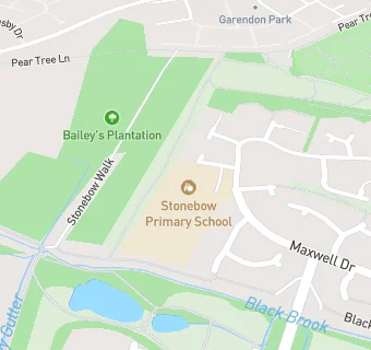
Stonebow Primary School Loughborough
Stonebow Primary School Loughborough
Stonebow Close
Loughborough
Leicestershire
England
LE114ZHLeicestershire
England
👩🏫 headteacher: Mrs Olivia Wood
Primary — Community school
- URN
- 120104
- Education phase
- Primary
- Establishment type
- Community school
- Establishment #
- 2382
- Close date
- 31. January 2013
- Reason closed
- Academy Converter
- OSGB coordinates
- Easting: 450579, Northing: 320686
- GPS coordinates
- Latitude: 52.781, Longitude: -1.2516
- Accepting pupils
- 4—11 years old
- Boarders
- No boarders
- Region › Const. › Ward
- East Midlands › Loughborough › Loughborough Dishley and Hathern