BLOCLSchools

Temple Park Infants' School closed - result of amalgamation/merger 31. August 2011

redirecting to Forest View Primary

Temple Park Infants' School
Rubens Avenue
South Shields
Tyne and Wear
England
NE348JU

👩‍🏫 headteacher: Mrs Cheryl Porter


Primary — Community school

URN
108681
Education phase
Primary
Establishment type
Community school
Establishment #
2032
Close date
31. August 2011
Reason closed
Result of Amalgamation/Merger
OSGB coordinates
Easting: 436566, Northing: 563177
GPS coordinates
Latitude: 54.962, Longitude: -1.4305
Accepting pupils
5—7 years old
Boarders
No boarders
Region › Const. › Ward
North East › South Shields › Whiteleas
SEN priorities
SpLD - Specific Learning Difficulty
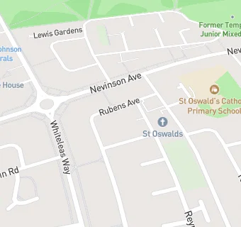
map for Temple Park Infants' School

Near Temple Park …

  1. Schools Primary
  2. 0.1 milesSt Oswald's Catholic Primary School, South Shields, NE348NS (234 pupils)
  3. 0.4 milesForest View Primary, NE348RZ (245 pupils)
  4. 0.6 milesBiddick Hall Junior School, NE349SP (228 pupils)
  5. 0.7 milesBiddick Hall Infants' School, NE349JD (236 pupils)
  6. 0.7 milesHoly Trinity Church of England Academy (South Shields), NE340TS (243 pupils)
  7. 0.8 milesRidgeway Primary Academy, NE348AB (459 pupils)
  8. 0.9 milesMonkton Infants' School, NE349SD (151 pupils)
  9. 1.0 mileCleadon Church of England Academy, SR67RP (470 pupils)
  10. 1.0 mileSS Peter and Paul Catholic Primary School, South Shields, NE334RH (235 pupils)
  11. 1.1 milesMonkton Academy, NE349RD (192 pupils)
  12. Schools
  13. 0.6 milesEpinay Business and Enterprise School, NE348BT (215 pupils)
  14. 1.1 milesAlternative Education Service - The Beacon Centre, NE340QA (62 pupils)
  15. Schools Nursery
  16. 1.1 milesHelen Gibson Nursery School, NE360DL (83 pupils)
  17. Schools Secondary
  18. 0.9 milesSt Wilfrid's RC College, NE340QA (1356 pupils)
  19. 1.0 mileBoldon School, NE359DZ (1056 pupils)
  20. Chemists
  21. 0.2 milesWhiteleas Pharmacy, NE348HF
  22. 0.4 milesBiddick Hall Pharmacy, NE349TQ
  23. Food Trucks
  24. 0.4 miles★★★★Contact Cooks, NE348JA
  25. Bars & Nightclubs
  26. 0.1 milesThe Fad, NE348JN
  27. 0.2 miles★★★★★WHITELEAS DISTRICT SOCIAL CLUB, NE348RN
  28. Retail Stores
  29. 0.2 miles★★★★Nisa Local, NE348HF
  30. 0.2 miles★★★★Premier Stores, NE348ND
  31. 0.2 milesWhiteleas Pharmacy, NE348HF
  32. 0.2 miles★★★★★M I Dickson Ltd, NE348HF
  33. School Food Ratings
  34. 0.1 miles★★★★★St. Oswald's Catholic Primary School, NE348NS
  35. 0.3 miles★★★★★Forest View Primary School, NE348RZ
  36. Takeaway Shops
  37. 0.2 miles★★★★Munch Box, NE348HF
  38. 0.2 miles★★★★Nevi's Chippy, NE348ND
  39. 0.2 miles★★★★★The Codfather, NE348HF
  40. 0.4 miles★★★★★Polaris Chinese Takeaway, NE349TQ

See all schools in South Shields