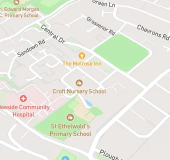
The Croft Nursery School
closed
1. September 2014
The Croft Nursery School
Larch Avenue, Aston
Queensferry
Deeside
Shotton
Wales
CH51NFYour feedback +
Welsh establishment
- URN
- 400000
- Establishment type
- Welsh establishment
- Establishment #
- 1003
- Close date
- 1. September 2014
- Reason closed
- Closure
- OSGB coordinates
- Easting: 330692, Northing: 367816
- GPS coordinates
- Latitude: 53.203, Longitude: -3.0391
- Region › Const. › Ward
- Wales › Alyn and Deeside › Shotton Higher
Near The Croft …
- Schools
- 0.1 milesSt Ethelwold's Primary School, CH51NG
- 0.4 milesQueens Ferry C.P. School, CH51SE
- 0.6 milesPlas Derwen, CH51EB
- 0.6 milesYsgol Ty Ffynnon, CH51HX
- 0.6 milesVen. Edward Morgan R.C. Primary School, CH51AR
- 0.8 milesPenarlag C.P. School, CH53RQ
- 1.0 mileHawarden High School, CH53DJ
- 1.0 mileYsgol Cae'r Nant, CH54QL
- 1.1 milesEwloe Green C.P. School, CH53AU
- 1.1 milesSandycroft C.P. School, CH52EH
- 1.3 milesSealand C.P. School, CH52HH
- 1.3 milesWepre C.P. School, CH54NE
- 1.4 milesHawarden Village Voluntary Aided C.I.W. Primary, CH53PY
- 1.5 milesBryn Deva C.P. School, CH54SN
- 1.8 milesGolftyn C.P. School, CH54XA
- Care Facilities
- ★★★★The Croft Playgroup, CH51NF
- ★★★★★The Oaks Nursing Home, CH51NF
- ★★★★★Flying Start, CH51NF
- 0.1 miles★★★★★Deeside Community Hospital, CH51XS
- 0.2 miles★★★★Hollybank Care Home, CH51QS
- Food Trucks
- 0.2 miles★★★★★Enjoy Desserts t/a Queensferry Institute, CH51UA
- Bars & Nightclubs
- 0.1 miles★★★★Melrose Inn, CH51LR
- 0.2 miles★★★★★The Plough Inn, CH51TJ
- Restaurants & Cafés
- 0.2 miles★★★★★Leon's Café/Deli, CH51UA
- Supermarkets
- 0.1 miles★★★★★The Co-operative Group, CH51LR
- School Food Ratings
- ★★★★★NEWydd Catering & Cleaning Ltd, CH51NG
- 0.3 miles★★★★★NEWydd Catering & Cleaning Ltd, CH51AS
- Takeaway Shops
- 0.1 miles★★★★Golden Fry, CH51LR
- 0.2 miles★★★★Spices, CH51UA
- 0.2 miles★★★★Enjoy Desserts, CH51UA
See all schools in Shotton