- Blocl
- Schools
- Liverpool
Tiber Street Infant School
closed
1. September 1994
redirecting to
Tiber County Primary School
Your feedback +
Primary —
Community school
- URN
- 104582
- Education phase
- Primary
- Establishment type
- Community school
- Establishment #
- 2151
- Close date
- 1. September 1994
- OSGB coordinates
- Easting: 336895, Northing: 388964
- GPS coordinates
- Latitude: 53.394, Longitude: -2.9504
- Accepting pupils
- 5—7 years old
- Boarders
- No boarders
- Region › Const. › Ward
- North West › Liverpool, Riverside › Princes Park
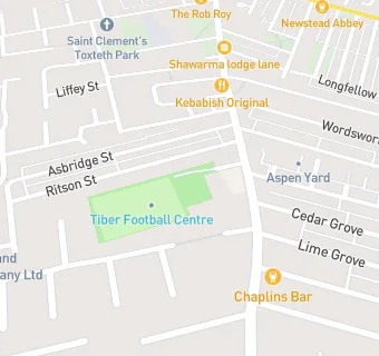
Schools nearby
- Tiber Street Junior School,
L80TP
- Tiber Street Infant School,
L80TP
- Tiber County Primary School,
L80TP
-
0.1
miles Dove Street Infant School,
L80TU
-
0.1
miles Elimu Academy,
L80TU
-
0.2
miles St Bernard's RC Junior Mixed and Infant School,
L82TY
-
0.2
miles Kingsley Community School,
L82TG
(493 pupils)
-
0.3
miles Granby Junior Mixed and Infant School,
L82TU
-
0.3
miles Princes School,
L81YQ
(165 pupils)
-
0.3
miles Princes School,
L81YQ
-
0.4
miles Chatsworth Junior Mixed and Infant School,
L76LJ
-
0.4
miles Archbishop Blanch CofE High School,
L76HQ
(1029 pupils)
-
0.4
miles Chatsworth County Infant School,
L76LJ
-
0.4
miles Smithdown Primary School,
L76LJ
(470 pupils)
-
0.5
miles Chatham Place Nursery School,
L76HD
(51 pupils)
-
0.5
miles Earle Primary School,
L76HQ
-
0.5
miles St Hugh's Catholic Primary School,
L76HE
(197 pupils)
-
0.5
miles Bellerive FCJ Catholic College,
L83SB
-
0.5
miles St Saviour's CofE Junior Mixed and Infant School,
L131BD
-
0.5
miles Bellerive FCJ Catholic College,
L173AA
(865 pupils)
-
0.6
miles Toxteth Pupil Referral Unit,
L81TH
-
0.6
miles St Hilda's Church of England High School,
L173AL
(1096 pupils)
-
0.6
miles Earle County Infant School,
L76PB
-
0.6
miles St Sila's CofE Infant School,
L87SA
-
0.6
miles An-Nur Primary School,
L81TH
🚸
schools in Liverpool