Be LocalSchools / Newcastle upon Tyne

West Denton High School closed - change religious character 31. August 2002

redirecting to All Saints College

West Denton High School
West Denton Way
Newcastle upon Tyne
Tyne and Wear
England
NE52SZ

👨‍🏫 headteacher: Mr Michael Quincey


Secondary — Community school

Admissions policy
Non-selective
URN
108522
Education phase
Secondary
Establishment type
Community school
Establishment #
4427
Close date
31. August 2002
Reason closed
Change Religious Character
OSGB coordinates
Easting: 419387, Northing: 566657
GPS coordinates
Latitude: 54.994, Longitude: -1.6985
Accepting pupils
13—18 years old
Boarders
No boarders
Region › Const. › Ward
North East › Newcastle upon Tyne North › Denton & Westerhope
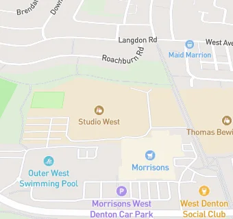
map for West Denton High School

Near West Denton …

  1. Schools Secondary
  2. Studio West, NE52SZ (555 pupils)
  3. Schools
  4. 0.2 milesThomas Bewick School, NE52LW (337 pupils)
  5. 0.2 milesMary Astell Academy, NE52LW (67 pupils)
  6. Schools Primary
  7. 0.3 milesBeech Hill Primary School, NE52LW (447 pupils)
  8. 0.4 milesWest Denton Primary School, NE51DN (335 pupils)
  9. 0.5 milesWesterhope Primary School, NE51NE (415 pupils)
  10. 0.5 milesSt John Vianney Catholic Primary School, West Denton, NE51DN (445 pupils)
  11. 0.7 milesFarne Primary School, NE54AP (236 pupils)
  12. 0.7 milesSt Mark's Catholic Primary School, Westerhope, NE54BT (210 pupils)
  13. 0.8 milesMilecastle Primary School, NE51LH (203 pupils)
  14. 0.9 milesCheviot Primary School, NE54EB (206 pupils)
  15. 0.9 milesKnop Law Primary School, NE51DS (406 pupils)
  16. 0.9 milesHilton Primary Academy, NE53RN (435 pupils)
  17. 1.0 mileBroadwood Primary School, NE157TB (215 pupils)
  18. 1.0 mileSimonside Primary School, NE54LG (275 pupils)
  19. Chemists
  20. 0.1 milesBoots, NE52QZ
  21. Dentists
  22. 0.1 milesWesterhope Limited, NE52QZ
  23. Doctors
  24. 0.1 milesDenton Park Medical Group, NE52QW
  25. 0.1 milesDenton Park Medical Group, NE52QW
  26. Bars & Nightclubs
  27. 0.1 miles★★West Denton Social Club, NE52QZ
  28. Retail Stores
  29. 0.1 milesCard Factory, NE52RA
  30. 0.1 miles★★★★★Specials, NE52RA
  31. 0.2 miles★★★★★Maid Marion Foodstore And Off-Licence, NE55JH
  32. Supermarkets
  33. 0.1 miles★★★★★Morrisons, NE52RA
  34. School Food Ratings
  35. ★★★★★Studio West Cafe, NE52SZ
  36. 0.2 miles★★★★★Thomas Bewick School, NE52LW
  37. 0.2 miles★★★★★Mary Astell Academy, NE52LW
  38. Takeaway Shops
  39. 0.1 miles★★★★★Greggs, NE52RA
  40. 0.1 miles★★★★Gills Fish And Chips, NE52RA
  41. 0.1 miles★★★★★Papa Johns, NE52RA

See all schools in Newcastle upon Tyne