Be LocalSchools / Staffordshire / Newcastle under Lyme

Wolstanton Preparatory School closed 23. September 1999

Wolstanton Preparatory School
30 Woodland Avenue
Wolstanton
Newcastle under Lyme
Staffordshire
England
ST58AZ

👨‍🏫 headteacher: Mr J Butler


Other independent school

Admissions policy
Non-selective
URN
124479
Establishment type
Other independent school
Establishment #
6020
Close date
23. September 1999
OSGB coordinates
Easting: 385205, Northing: 348416
GPS coordinates
Latitude: 53.033, Longitude: -2.2221
Accepting pupils
3—11 years old
Boarders
No boarders
Region › Const. › Ward
West Midlands › Newcastle-under-Lyme › Wolstanton
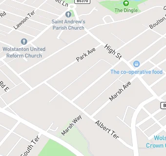
map for Wolstanton Preparatory School

Near Wolstanton Preparatory …

  1. Schools
  2. 0.1 milesCedars - Newcastle, Moorlands and Darwin Bases, ST56BX (45 pupils)
  3. 0.2 milesKaleidoscope School, ST50EZ (29 pupils)
  4. 0.6 milesMerryfields School, ST59NY (108 pupils)
  5. Schools Nursery
  6. 0.2 milesOaklands Nursery School, ST50EX (38 pupils)
  7. Schools Primary
  8. 0.2 milesEllison Primary Academy, ST50BL (367 pupils)
  9. 0.4 milesSt Margaret's CofE (VC) Junior School, ST50HU (231 pupils)
  10. 0.5 milesSt Wulstan's Catholic Primary School, ST50EF (410 pupils)
  11. 0.7 milesMay Bank Infants' School, ST50PT (167 pupils)
  12. 0.7 milesHempstalls Primary School, ST59LH (422 pupils)
  13. 0.8 milesSun Academy Bradwell, ST58JN (164 pupils)
  14. 0.9 milesBursley Academy, ST58JQ (365 pupils)
  15. 1.0 mileChurchfields Primary School, ST57HY (393 pupils)
  16. 1.1 milesChesterton Primary School, ST57NT (166 pupils)
  17. 1.2 milesSaint Nathaniel's Academy, ST64JG (481 pupils)
  18. Schools Secondary
  19. 0.4 milesThe Orme Academy, ST59JU (749 pupils)
  20. Care Facilities
  21. 0.2 miles★★★★★OAKLANDS NURSERY, ST50EX
  22. 0.2 miles★★★★★SOUTHLANDS NURSERIES LTD, ST58BZ
  23. Chemists
  24. 0.1 milesCornwell's Chemists, ST50ER
  25. 0.2 milesCornwell's Chemists, ST50EP
  26. Dentists
  27. 0.2 milesP Najran Limited, ST50HE
  28. 0.2 milesWolstanton Dental Practice, ST50BJ
  29. Doctors
  30. 0.1 milesThe Village Surgery, ST50ET
  31. 0.1 milesThe Village Surgery, ST50ET
  32. 0.2 milesWolstanton Medical Centre, ST58BN
  33. 0.2 milesWolstanton Medical Centre, ST58BN
  34. Bars & Nightclubs
  35. 0.1 miles★★★★★WULSTAN, ST58BU
  36. 0.2 miles★★★★★WOLSTANTON HIGH STREET CLUB, ST50HE
  37. Supermarkets
  38. 0.2 miles★★★★★NISA LOCAL, ST50EW
  39. School Food Ratings
  40. 0.2 miles★★★★★KALEIDOSCOPE SCHOOL, ST50EZ
  41. Takeaway Shops
  42. 0.2 miles★★★★★WRIGHTS PIES, ST50EW

See all schools in Newcastle under Lyme