Ynyshir Infants School
closed
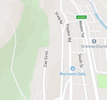
Ynyshir Infants School
Gynor Place
Ynyshir
Porth
Wales
CF390NR📞 phone: 14436 *** ***
Your feedback +
Welsh establishment
- URN
- 401244
- Establishment type
- Welsh establishment
- Establishment #
- 2277
- OSGB coordinates
- Easting: 302324, Northing: 192819
- GPS coordinates
- Latitude: 51.626, Longitude: -3.4124
- Region › Const. › Ward
- Wales › Rhondda › Ynyshir
Near Ynyshir Infants …
- Schools
- 0.2 milesYnyshir Primary School, CF390HU
- 0.7 milesPorth Community School, CF390BS
- 1.1 milesYsgol G. G. Llwyncelyn, CF399TL
- 1.1 milesAlaw Primary School, CF402UU
- 1.2 milesPontygwaith Primary School, CF433LY
- 1.3 milesYsgol Gyfun Cymer Rhondda, CF399HA
- 1.4 milesCymmer Primary School, CF399EY
- 1.5 milesTrealaw Primary School, CF402QW
- 1.6 milesTai Educational Centre, CF401HL
- 1.7 milesHafod Primary School, CF372NL
- 1.7 milesTylorstown Primary School, CF433HH
- 1.8 milesWilliamstown Primary School, CF401AG
- 1.8 milesSt Gabriel & Raphael R.C.P. School, CF401BJ
- 1.8 milesPenrhys Primary School, CF433PL
- 2.0 milesPontrhondda Primary School, CF402SZ
- Care Facilities
- 0.5 miles★★★★★Cylch Meithrin, CF390RA
- 0.6 miles★★★★★Home From Home Children's Day Nursery Ltd, CF390DF
- 1.1 miles★★★★Cylch Meithrin Bysedd Bach, CF399TL
- 1.1 miles★★★★★Sparkles Day Nursery, CF399PG
- 1.3 miles★★★★★Autism Life Centres, CF402UD
- Food Trucks
- 0.2 miles★★★★★Rees's Diner Cafe Van, CF390AH
- Bars & Nightclubs
- 1.1 miles★★★★★Pontygwaith Non Political Workingmens Club, CF433LA
- Restaurants & Cafés
- 1.1 miles★★★★★The Factory, CF399PP
- 1.3 miles★★★★★Par 70, CF433PW
- Retail Stores
- 0.4 milesLenny's Lugger, CF390LB
- 0.8 milesThe Original Factory Shop, CF399BT
- 0.8 milesAllied Pharmacy, CF390LD
- 0.8 miles★★★★★Greggs, CF399BL
- 1.0 mile★★★★MFG Porth Service Station, CF399SH
- 1.0 mile★★★Charlotte's Cakery, CF399NY
See all schools in Porth