BLOCLSchools

Ysgol Nant Y Coed closed - result of amalgamation/merger 1. September 2016
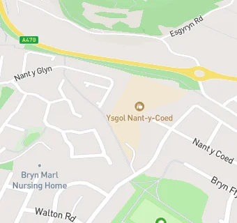
Ysgol Nant Y Coed
Rhodfa Ronald
Cyffordd Llandudno
Conwy
Conwy
Wales
LL319EU


Welsh establishment

URN
400224
Establishment type
Welsh establishment
Establishment #
2117
Close date
1. September 2016
Reason closed
Result of Amalgamation/Merger
OSGB coordinates
Easting: 280051, Northing: 378310
GPS coordinates
Latitude: 53.288, Longitude: -3.8008
Region › Const. › Ward
Wales › Aberconwy › Pensarn
map for Ysgol Nant Y Coed

Near Ysgol Nant …

  1. Schools
  2. 0.4 milesYsgol Awel y Mynydd, LL319HG
  3. 0.9 milesYsgol Deganwy, LL319YB
  4. 1.5 milesYsgol Aberconwy, LL328ED
  5. 1.5 milesSt David's College, LL301RD
  6. 1.5 milesMochdre Infants C.P. School, LL285EF
  7. 1.5 milesYsgol Glan Conwy, LL285ST
  8. 1.5 milesYsgol Porth y Felin, LL328FZ
  9. 1.7 milesYsgol Cystennin, LL285AU
  10. 1.8 milesYsgol Glanwydden, LL303LB
  11. 1.9 milesBlessed William Davies School, LL301LL
  12. 1.9 milesYsgol Y Creuddyn, LL303LB
  13. 2.2 milesYsgol Morfa Rhiannedd, LL301EG
  14. 2.2 milesYsgol Craig Y Don, LL301TR
  15. 2.2 milesYsgol Y Gogarth, LL301YE
  16. 2.2 milesYsgol Bodafon, LL303BA
  17. Care Facilities
  18. 0.1 miles★★★★★Bryn Marl Nursing Home, LL319YX
  19. Chemists
  20. 0.3 milesBoots, LL319DU
  21. Food Trucks
  22. 0.3 miles★★★★★Sarah's Cafe, LL319EG
  23. Restaurants & Cafés
  24. 0.3 miles★★★★★Coffee Junction, LL319AY
  25. 0.3 miles★★★★Providero North Wales, LL319DU
  26. 0.3 miles★★★★★Ku-mes Sandwich Bar, LL319DU
  27. Retail Stores
  28. 0.3 miles★★★★★One Six Nine, LL319EG
  29. 0.3 milesBoots UK Ltd, LL319DU
  30. Supermarkets
  31. 0.3 miles★★★★★Co Op,
  32. Takeaway Shops
  33. 0.3 miles★★★★Enochs Fish & Chips, LL319DU
  34. 0.3 miles★★★★★Chang Lung, LL319AY
  35. 0.3 miles★★★★★Bay Grill II, LL319DU
  36. 0.4 miles★★★Fu House, LL319ND
  37. 0.4 miles★★★★Golden City, LL319LN
  38. 0.4 miles★★★★★Junction Chinese Take Away, LL319ND

See all schools in Conwy