Ysgol y Parc
closed
- result of amalgamation/merger
31. August 2017
Ysgol y Parc
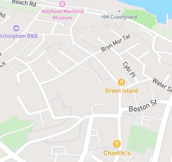
Newry Fields
Holyhead
Wales
LL651LAYour feedback +
Welsh establishment
- URN
- 400053
- Establishment type
- Welsh establishment
- Establishment #
- 2144
- Close date
- 31. August 2017
- Reason closed
- Result of Amalgamation/Merger
- OSGB coordinates
- Easting: 224597, Northing: 382792
- GPS coordinates
- Latitude: 53.313, Longitude: -4.6344
- Region › Const. › Ward
- Wales › Ynys Môn › Caergybi
Near Ysgol y …
- Schools
- 0.2 milesYsgol Uwchradd Caergybi, LL651NP
- 0.3 milesYsgol Santes Fair, St Mary' s R.C. School, LL651TR
- 0.4 milesYsgol Cybi, LL651NS
- 0.6 milesYsgol Llanfawr, LL652DS
- 1.0 mileYsgol Gynradd Kingsland, LL652TH
- 1.0 mileYsgol Gymraeg Morswyn, LL652TH
- 3.5 milesYsgol Gymuned Fali, LL653EU
- 3.7 milesYsgol Gynradd Santes Gwenfaen, LL652DX
- 5.0 milesYsgol y Tywyn, LL653NP
- 5.0 milesYsgol Caergeiliog Foundation School, LL653NP
- 5.0 milesYsgol Rhyd y Llan, LL654PQ
- 5.5 milesYsgol Gynradd Bodedern, LL653TL
- 5.6 milesYsgol Uwchradd Bodedern, LL653SU
- 7.2 milesYsgol Gymuned Bryngwran, LL653PP
- 7.4 milesYsgol Gynradd Rhosneigr, LL645XA
- Bars & Nightclubs
- 0.1 miles★★★★Holyhead Conservative Club, LL651HG
- 0.1 miles★★★★The Stanley Arms, LL651HL
- 0.1 miles★★★★★Cambria Inn, LL651NH
- 0.1 miles★★★★★The Albert Vaults, LL651HL
- Restaurants & Cafés
- 0.1 miles★★★★★Happy Belly Deli, LL651NH
- 0.2 miles★★★★★Cwt Crempog, LL651NP
- Retail Stores
- ★★★★★Newry Stores, LL651HP
- 0.1 miles★★★★Chadwicks Newsagents, LL651BW
- 0.1 miles★★★★★Empire Complex, LL651HL
- 0.1 miles★★★J M Butchers, LL651HG
- 0.2 miles★★★★★Cybi Stores, LL651RS
- Takeaway Shops
- ★★★★★Green Island Chinese, LL651HP
- 0.1 miles★★★★★Dolphin Fish Bar, LL651NH
- 0.1 miles★★★Picnics, LL651HG
- 0.1 miles★★★★★The Chippy, LL651DD
See all schools in Holyhead