BLOCLEats

Bluesign Londis

Service Station South Side
Coast Road
Wallsend
Tyne And Wear
NE289HS

Food rating: ★★★★★ 5/5 stars
Updated: 26. September 2022

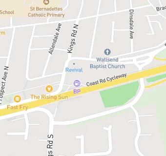
map for Bluesign Londis

Near Bluesign Londis

  1. Retail Stores
  2. 0.1 milesCoast Road Pharmacy, NE289HP
  3. 0.1 miles★★★★★One Stop, NE289HP
  4. 0.2 miles★★★★★Vijay's Off Licence, NE289HZ
  5. 0.3 miles★★★★★Ace Teepee Adventures (Child), NE289JW
  6. 0.4 miles★★★★★High Farm Convenience Store, NE288NN
  7. 0.4 miles★★★★★Premier Stores, NE288DA
  8. 0.4 miles★★★★★Drinks Express, NE288DA
  9. 0.4 miles★★★★★Life Vineyard,
  10. Food Trucks
  11. 0.1 miles★★★★★John's Ice's MW12 VFE, NE287QQ
  12. Catering Services
  13. 0.2 miles★★★★★Fun Little Foodies - Newcastle East, NE289JF
  14. Bars & Nightclubs
  15. 0.1 miles★★★★★Rising Sun\*, NE289HP
  16. 0.2 miles★★★★★Westholme Farm Social Club, NE289LH
  17. Takeaway Shops
  18. 0.1 miles★★★Porky's/A And S Buffets, NE289HP
  19. 0.1 miles★★★★★The Mandarin, NE289HP
  20. 0.1 milesFast Fry, NE289HP
  21. Chemists
  22. 0.1 milesCoast Road Pharmacy, NE289HP
  23. Schools
  24. 0.3 milesBeacon Hill School, NE289JW (232 pupils)
  25. Schools Primary
  26. 0.3 milesSt Bernadettes Catholic Primary, Wallsend, NE289JW (318 pupils)
  27. 0.4 milesWallsend Jubilee Primary School, NE289HA (384 pupils)
  28. 0.5 milesSt Columba's Catholic Primary School, Wallsend, NE288EN (210 pupils)
  29. 0.7 milesRedesdale Primary School, NE288TS (335 pupils)

See all Retail Stores in Wallsend.