BLOCLEats

Dronfield County Junior School

School Lane
Dronfield
S181RY

Food rating: ★★★★★ 5/5 stars
Updated: 29. January 2024

Food ratings

Hygiene: 5

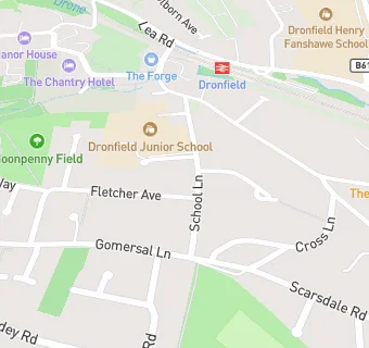
map for Dronfield County Junior School

Near Dronfield County …

  1. School Food Ratings
  2. ★★★★★S L K C (School Lane Kids Club), S181RY
  3. ★★★★★Dronfield County Infants School, S181RY
  4. 0.5 miles★★★★★TRIBE Bushcraft Centre, S181XX
  5. 0.6 miles★★★★★Holmesdale Infants School, S182LR
  6. 0.6 miles★★★★★Lenthall Children's Club, S182HB
  7. 0.6 miles★★★★★Lenthall Infants School, S182HB
  8. 0.7 miles★★★★★Stonelow Junior School, S182EP
  9. 0.9 miles★★★★★Northfield Junior School, S182ED
  10. Catering Services
  11. 0.1 miles★★★★★Oaks Community Church Food Service, S181SB
  12. Bars & Nightclubs
  13. 0.2 miles★★★★★The Bar At The Forge, S181QX
  14. Retail Stores
  15. 0.2 miles★★★★★Olive Tree Home \& Gifts, S181QX
  16. 0.2 milesNewburys Newsagents, S182XB
  17. Supermarkets
  18. 0.2 miles★★★★★The Corner Shop, S181PD
  19. Takeaway Shops
  20. 0.2 miles★★★Fat Sam's, S182XB
  21. 0.2 miles★★★★★The Deli, S182XB
  22. Chemists
  23. 0.2 milesDronfield Pharmacy, S182XL
  24. Schools Primary
  25. 0.1 milesDronfield Junior School, S181RY (336 pupils)
  26. 0.1 milesDronfield Infant School, S181RY (212 pupils)
  27. 0.5 milesDronfield Stonelow Junior School, S182EP (136 pupils)
  28. 0.6 milesHolmesdale Infant School, S182LR (147 pupils)
  29. Schools Secondary
  30. 0.2 milesDronfield Henry Fanshawe School, S182FZ (1881 pupils)

See all School Food Ratings in Dronfield.