BLOCLEats

Holland And Barrett

45 High Street
Newport
Isle Of Wight
PO301SE

Food rating: ★★★★★ 5/5 stars
Updated: 20. July 2016

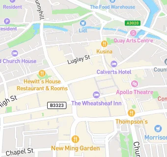
map for Holland And Barrett

Near Holland And …

  1. Retail Stores
  2. Lloyds Pharmacy, PO301XB
  3. Superdrug Stores Plc, PO301TP
  4. TK Maxx, PO301XB
  5. ★★★★★Central Convenience Stores, PO301TP
  6. ★★★★Grace's Bakery, PO301XA
  7. Boots UK Ltd, PO301TP
  8. Clinton Cards, PO301SE
  9. 0.1 miles ★★★★★Grace's Bakery, PO301TJ
  10. Catering Services
  11. ★★★★★Independent Arts, PO301SE
  12. Bars & Nightclubs
  13. ★★★★★Wheatsheaf Hotel, PO301SG
  14. Restaurants & Cafés
  15. ★★★★★Wyld, PO301XB
  16. ★★★★★The Blue Door Cafe, PO301UX
  17. ★★★★★Papa P's, PO301SG
  18. Supermarkets
  19. ★★★★★Tesco Express (2360), PO301TJ
  20. Takeaway Shops
  21. ★★★★★Costa, PO301UX
  22. ★★★Kenny's Newport Ltd, PO301UX
  23. Schools
  24. 0.5 miles Medina House School, PO302HS (107 pupils)
  25. Schools 16 Plus
  26. 0.4 miles The Isle of Wight College, PO305TA
  27. Schools Primary
  28. 0.4 miles Barton Primary School, PO302AX (257 pupils)
  29. 0.4 miles Nine Acres Primary School, PO301QP (409 pupils)
  30. 0.4 miles Newport Church of England Aided Primary School, PO305GD (299 pupils)