BLOCLEats

The Anchor

166 High Street West
Wallsend
Tyne And Wear
NE288HZ

Food rating: ★★★★★ 5/5 stars
Updated: 25. April 2019

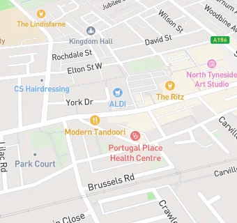
map for The Anchor

Near The Anchor

  1. Bars & Nightclubs
  2. ★★★★★Queens Head, NE288HZ
  3. 0.1 miles ★★★★★Wallsend RAOB Club And Institute Ltd, NE286RT
  4. 0.1 miles ★★★★★The Ritz, NE288JD
  5. 0.1 miles ★★★★★The Ship, NE288JD
  6. 0.1 miles ★★★★★Duke Of York, NE288JD
  7. 0.2 miles ★★★★★Admiral Casino, NE288HU
  8. 0.2 miles ★★★★★The Anson, NE288QS
  9. 0.3 miles ★★★★★The Miner's Club And Bella Carvery, NE288RG
  10. Care Facilities
  11. 0.1 miles ★★★★★UBU, NE286RT
  12. Catering Services
  13. ★★★★★Hot Roast Deli, NE288HZ
  14. Retail Stores
  15. ★★MK Mini Market, NE288HZ
  16. 0.1 miles Savers Health And Beauty, NE288JA
  17. Supermarkets
  18. 0.1 miles ★★★★★Iceland Foods Ltd, NE288JP
  19. Takeaway Shops
  20. 0.1 miles ★★★Planet Mash Burger & Gourmet Burger N Wrap, NE288HY
  21. Chemists
  22. 0.1 miles Wallsend Pharmacy, NE288JA
  23. Doctors
  24. Portugal Place Health Centre, NE286RZ
  25. Schools Primary
  26. 0.2 miles Western Community Primary School, NE288QL (455 pupils)
  27. 0.2 miles Carville Primary School, NE286AX (184 pupils)
  28. 0.2 miles Carville Primary School, NE286AX
  29. 0.4 miles St Columba's Catholic Primary School, Wallsend, NE288EN (210 pupils)
  30. 0.6 miles Richardson Dees Primary School, NE287RT (230 pupils)