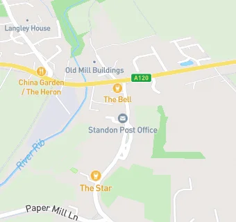
BLOCLEats

Westwoods

Westwoods
2 High Street
Standon
Hertfordshire
SG111LA

Food rating: ★★★★★ 5/5 stars
Updated:

map for Westwoods

Near Westwoods

  1. Retail Stores
  2. ★★★★★Days Of Ashwell, SG111LA
  3. Post Office & Convenience Store, SG111LA
  4. 0.9 miles★★★★★Puckeridge Local Store, SG111RN
  5. 0.9 milesRidge House Pharmacy, SG111RN
  6. 1.6 miles★★★★★Bridget B's @ Pearces Farm Shop, SG99ND
  7. 1.6 miles★★★★★Pearce's Farm Shop & Cafe, SG99ND
  8. 1.8 miles★★★★H & N Jones, SG112PG
  9. 2.4 miles★★★★★Campus & Co, SG111BT
  10. Care Facilities
  11. 0.4 miles★★★★★Wasps Out Of School Club, SG111TF
  12. Food Trucks
  13. 0.5 miles★★★★★The Lobster Pot, SG111QF
  14. 0.5 miles★★★★★The Tipsy Oyster, SG111QF
  15. Bars & Nightclubs
  16. ★★★★★The Bell, SG111LA
  17. 0.1 miles★★★Star Public House, SG111LB
  18. 0.5 milesStandon And Puckeridge Community Centre, SG111TF
  19. Restaurants & Cafés
  20. 0.2 miles★★★★★China Garden, SG111QW
  21. School Food Ratings
  22. 0.5 miles★★★★★Roger De Clare First School, SG111TF
  23. Schools
  24. 1.5 milesSt Edmund's College, SG111DS (863 pupils)
  25. Schools Middle Deemed Secondary
  26. 0.5 milesRalph Sadleir School, SG111TF (319 pupils)
  27. Schools Primary
  28. 0.4 milesRoger De Clare First CofE School, SG111TF (246 pupils)
  29. 0.8 milesSt Thomas of Canterbury Catholic Primary School, SG111RZ (115 pupils)
  30. 1.6 milesJenyns First School and Nursery, SG112QJ (71 pupils)

See all Retail Stores in Puckeridge.