Apperknowle Community Primary School closed 31. August 2008
redirecting to
Unstone St Mary's Nursery & Infant School
redirecting to
Unstone Junior School
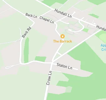
Apperknowle Community Primary School
Barrack Road
Apperknowle
Chesterfield
Derbyshire
England
S184AUChesterfield
Derbyshire
England
👩🏫 headteacher: Mrs Sheila Colebourn
Primary — Community school
- URN
- 112644
- Education phase
- Primary
- Establishment type
- Community school
- Establishment #
- 2263
- Close date
- 31. August 2008
- Reason closed
- Closure
- OSGB coordinates
- Easting: 438086, Northing: 378086
- GPS coordinates
- Latitude: 53.298, Longitude: -1.4300
- Accepting pupils
- 5—11 years old
- Boarders
- No boarders
- Region › Const. › Ward
- East Midlands › North East Derbyshire › Unstone